Saudi Arabia | More intense thunderstorms await the heights of Jizan, Asir, Al Baha and Taif

Written By سنان خلف on 2021/04/26

This article was written originally in Arabic and is translated using a 3rd party automated service. ArabiaWeather is not responsible for any grammatical errors whatsoever.

Update | Tuesday 4/27/2021 at 2:30 am

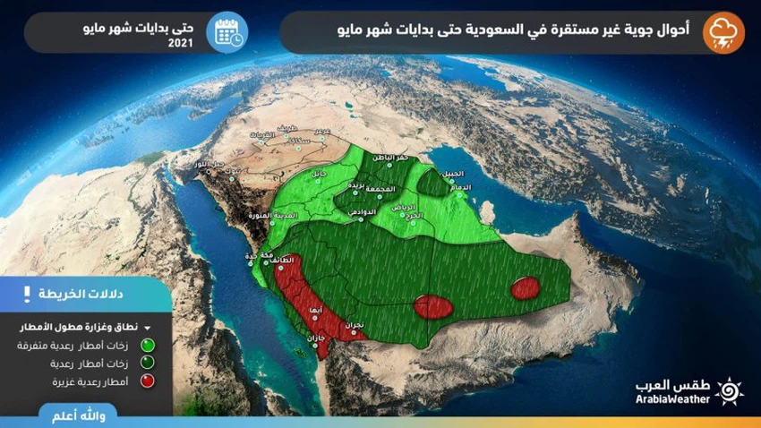
Arab Weather - Sinan Khalaf - It seems that the unstable weather conditions affecting days ago on the heights of the southwest of the Kingdom will take an upward trend in terms of intensity during the coming days and up to the beginning of May, in conjunction with the flow of more moist air coming from the Arabian Sea towards the region, and its collision With another air mass, the heat is coming from the north.


They are sometimes accompanied by showers of intense cold

Heavy rains and possible torrents of Jizan, Asir, Al-Baha and Taif


According to the latest outputs of numerical models, it is expected that the heights of Jizan, Asir , Al-Baha and Taif will be on a daily basis under the influence of powerful cumulus clouds, carrying with them heavy thunderstorms and showers of cold that will be dense and accumulated at times, with a high chance of torrents forming, especially in the regions. Low and mountainous slopes, and some of these clouds may extend around the eastern parts of the Makkah region, but with less intensity.


Some important recommendations:

Alert of the formation of floods locally in parts of the southwest and west of the Kingdom

- Warning about the intensity of hail showers that may accumulate and hinder the movement of vehicles

- Alert of the occurrence of thunderstorms and the accompanying activity of the surface winds that cause dust.

This article was written originally in Arabic and is translated using a 3rd party automated service. ArabiaWeather is not responsible for any grammatical errors whatsoever.


Browse on the official website


Rain clouds are affecting parts of the central and eastern parts of the Kingdom at this time.The Kingdom will continue to be affected by instability in the coming hours, with thunderstorms in these areas.A very cold polar air mass will settle over the eastern Mediterranean next week (very cold weather and very low temperatures)A strong high pressure system is controlling western Europe and causing a huge polar air mass to rush towards eastern Europe.A low pressure system will affect Gaza starting tonight, followed by a very cold air mass starting Saturday, February 22, 2025.Warning of heavy dust waves in the Badia of the Levant, Iraq and northern Saudi Arabia on Thursday, and they will be renewed at the beginning of next weekA very cold polar air mass will affect several countries in the eastern Mediterranean, accompanied by very low temperatures, starting from February 20, 2025.Low pressure and heavy rain in Gaza, followed by cold polar winds and worsening humanitarian conditionsMajor consequences of polar vortex split, resulting in a cold wave that brings temperatures to -50 degrees Celsius in the United States