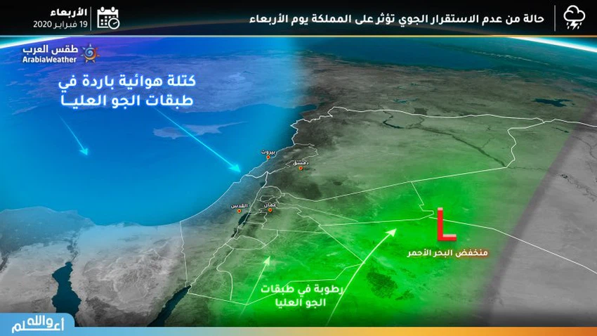
A state of air instability on Tuesday night and Wednesday ... and alerting of the formation of torrential rain in some areas
Weather of Arabia - As of Tuesday evening, the Kingdom is witnessing a state of atmospheric instability; accompanied by precipitation of varying intensity from thunderstorms, it may be heavy in some areas, especially with the hours of Tuesday / Wednesday night and Wednesday.
The effect of the instability continues on Wednesday
Cold and cloudy weather prevails on Wednesday in various regions, and showers of rain are expected at intervals, God willing, in different parts of the north, center and south of the Kingdom, including the province of Aqaba .
The temperature drops to 3-4 ° C below its normal levels .
Cold and cloudy weather at night ... and fog forecast
With night hours, the weather is generally cold and cloudy, and showers of thunderstorm continue in separate parts of the Kingdom, accompanied by showers of cold, especially in the south of the Kingdom .
Fog and clouds in contact with the surface of the earth are expected to form above the mountainous heights .
Arab Weather Recommendations
- Pay attention to the possibility of torrential rain in some areas due to the abundance of some rain showers
- Stay away from torrents and canyons
- Attention from slipping on the highlands of the southern highlands because of the possibility of hail falling during the situation .
- Attention from slipping on the highlands of the southern highlands because of the possibility of hail falling during the situation .

Browse on the official website