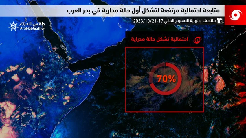
Scientific reading: The prevailing weather conditions in the Arabian Sea suggest the formation of the first tropical condition at the end of this week
Arabia Weather - The latest weather maps received from global centers and analyzes of weather forecasters at the Regional Arabia Weather Center indicate that the prevailing weather conditions in the Arabian Sea are likely to form the first tropical condition south of the Arabian Sea by the end of this week, but it is still not yet clear whether the possibility The evolution of this orbital system and the path it may take is difficult to know precisely from now before the orbital state is formed on the ground.
It is expected, God willing, according to the latest weather updates, that an area of low air pressure will form between Tuesday and Wednesday, October 17 and 18, southeast of the Arabian Sea.

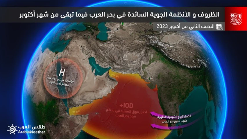
The most important weather conditions prevailing in the Arabian Sea that support the formation of the first tropical state
Specialists at the Arabia Weather Center reported that the Arabian Sea will host the first tropical event in its second season of tropical activity in the northern Indian Ocean, which climatically usually begins at the beginning of October, with the prevailing conditions likely to be prepared for its development.
- The water in the Arabian Sea is witnessing a rise in the temperature of its water body above its usual levels by several degrees Celsius, and hot water is considered the fuel that operates these tropical systems.
- The decline of the summer monsoon winds also gives a good indication that the tropical state will find a suitable environment for shear winds and thus the tropical state will develop.
- Dry winds move away from the Arabian Sea.
On a related level, and according to the analytical data at the “Arab Weather Center”, if the tropical condition forms in the south of the Arabian Sea by the end of next week, the south of the Arabian Peninsula will naturally be one of the possible paths, especially with expectations that the upper air elevation will be relatively far from its southern parts, In addition to the refraction of the eastern winds in its southern parts. “Arab Weather” will provide followers with detailed forecasts as soon as weather information is available and stable, God willing.

Browse on the official website