المنطقة الشرقية على موعد مع بوارح مثيرة للغبار من الثلاثاء حتى السبت
موقع طقس العرب – م. ناصر حداد – من المنتظر أن تهب رياح البوارح على المنطقة الشرقية اعتباراً من نهار الثلاثاء ولغاية السبت (من 20 حتى 24 يونيو / حزيران)، تعمل على اثارة الغبار في المناطق الداخلية كما تميل درجات الحرارة الى الانخفاض مع بقائها حارة عموماً.
وتكون الرياح خلال هذه الفترة شمالية الى شمالية غربية نشطة السرعة وقد يصل معدل سرعتها الى 35-40 كم/ساعة، مع هبات قوية أحيانا يصل أقصاها الى 60-65 كم/ساعة.
وتشير الخرائط الجوية الى تزايد تدريجي بحركة الرياح اعتباراً من ساعات نهار يوم الثلاثاء ولغاية السبت، حيث تجلب الغبار على المناطق الداخلية من الشرقية مع ساعات النهار والعصر، فيما يبقى الطقس صافياً على السواحل مع احتمال ضعيف لبعض الغبار العالق او الخفيف في مناطق محدودة من الدمام والجبيل.
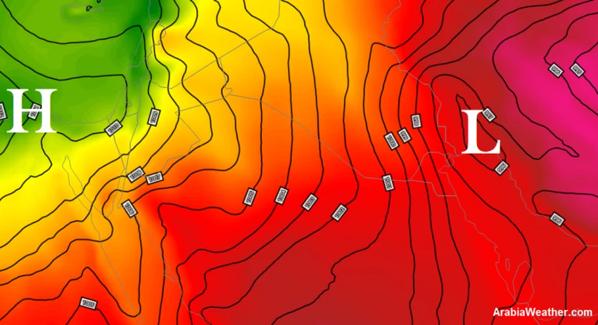
ويعود سبب نشاط الرياح الى اندفاع كتلة هوائية أكثر برودة شمال المملكة، قادمة عبر شرق البحر المتوسط وبلاد الشام، تعمل على زيادة فرق الضغط الجوي بينها وبين منخفض الهند الموسمي شرقاً، حسبما تبين الخريطة المرفقة لتوزيع الكتل الهوائية والضغط الجوي السطحي.
ويحذر من تدني مدى الرؤية الافقية في الهفوف والاحساء وباقي المناطق الداخلية من الشرقية، بسبب الغبار الذي قد يعمل على خفض مدى الرؤية الافقية الى حدود 1-3 كيلو متر.


Arabia Weather App
Download the app to receive weather notifications and more..