بالصور: موجة غبار تؤثر على الرياض وانخفاض مدى الرؤية الأفقية

2014-10-21 2014-10-21T07:28:51Z
عمر الدجاني
عمر الدجاني
متنبئ جوي- مسؤول قسم الأخبار الجوية

موقع ArabiaWeather.com- تتعرض العاصمة الرياض على فترات منذ يوم أمس لرياح نشطة وأتربة مثارة، كنتيجة لتشكّل مُنخفض جوي فوق الأراضي العراقية.


وكان المُنخفض الجوي قد عمل على هبوب رياح جنوبية نشطة على أجزاء من شمال شرق السعودية وشمال المنطقة الوسطى يوم الإثنين، ثم عملت رياح شمالية غربية على دفع بقايا موجة الغبار إلى بعض المناطق الوسطى والشرقية صباح الثلاثاء.

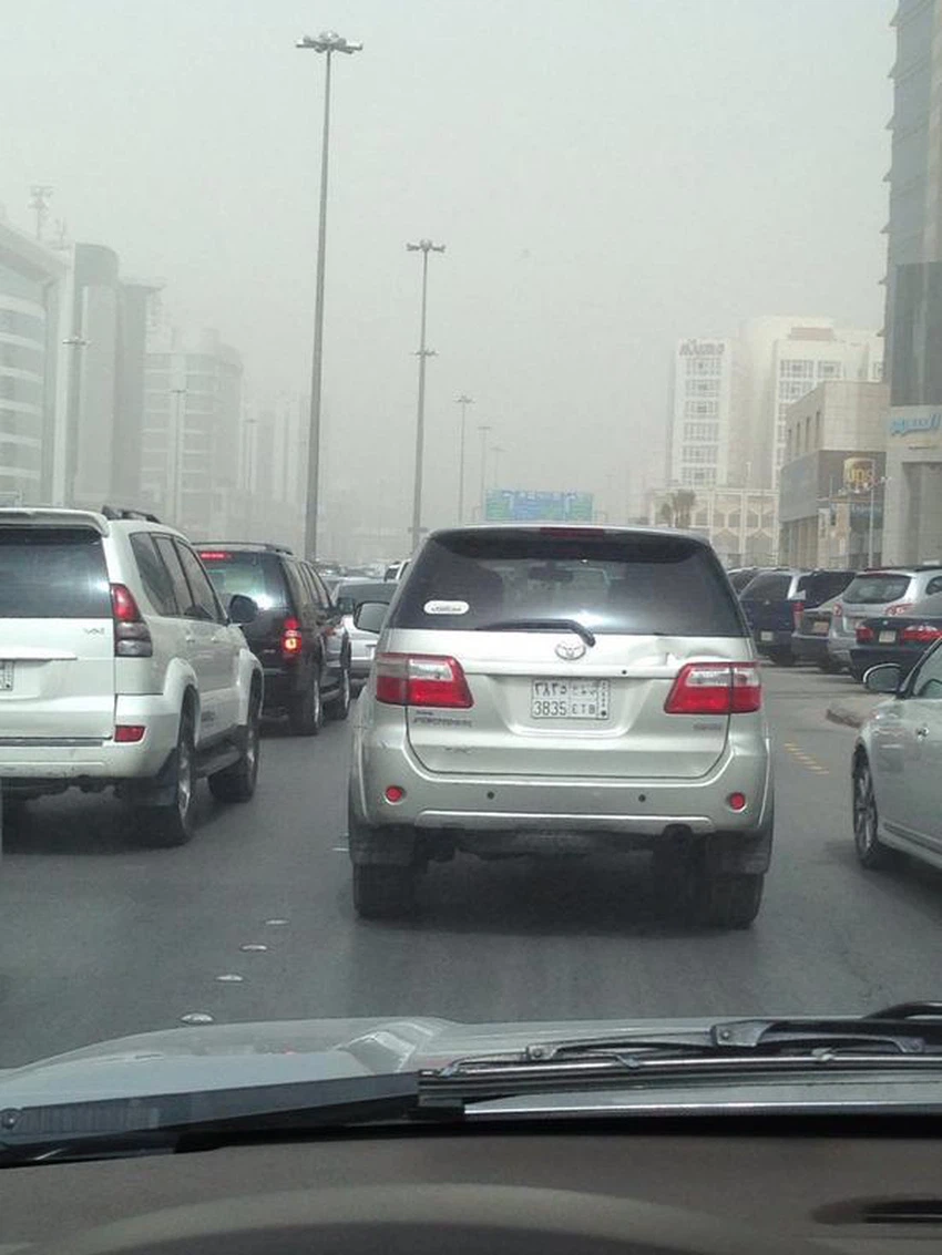
وأشار تقرير مطار الملك خالد الدولي مع الساعة التاسعة والعاشرة صباحاً إلى تدني مدى الرؤية الأفقية إلى أقل من 500 متر، حيث تمركزت موجة الغبار في الأحياء الشمالية والشرقية للعاصمة الرياض، وكانت بين الخفيفة والمتوسطة على عكس مطار الملك خالد الدولي.


ويتوقع أن تنحسر موجة الغبار تدريجياً خلال ساعات نهار الثلاثاء، في حين تبدأ درجات الحرارة في رحلتها التنازلية مع ساعات الليل بمشيئة الله.


مواضيع ذات صلة:


شاهد حركة الغبار مباشرة عبر الضغط هنا


حالة الطقس المتوقعة خلال الأيام القادمة

This article was written originally in Arabic and is translated using a 3rd party automated service. ArabiaWeather is not responsible for any grammatical errors whatsoever.
See More
Related News
The Arabian Peninsula High is intensifying and the rainy season is starting in India and the Bay of Bengal. What does this portend?

The Arabian Peninsula High is intensifying and the rainy season is starting in India and the Bay of Bengal. What does this portend?

A tropical high will intensify over the Kingdom, with temperatures reaching 40 degrees Celsius in the capital, Riyadh, at the end of the week.

A tropical high will intensify over the Kingdom, with temperatures reaching 40 degrees Celsius in the capital, Riyadh, at the end of the week.

A spring snow wave is affecting Türkiye and eastern Europe, with temperatures dropping to minus 13 degrees Celsius in some areas.

A spring snow wave is affecting Türkiye and eastern Europe, with temperatures dropping to minus 13 degrees Celsius in some areas.

Classified as unseasonal, a polar air mass is rushing into central and eastern Europe, causing a severe cold wave laden with snow (details)

Classified as unseasonal, a polar air mass is rushing into central and eastern Europe, causing a severe cold wave laden with snow (details)