عودة فرص الامطار على مرتفعات جنوب غرب المملكة في الأيام القادمة
2017-06-17
2017-06-17T18:30:01Z
موقع طقس العرب – م. ناصر حداد – يتوقع بمشيئة الله تزايد فرص زخات الأمطار على المرتفعات الجنوبية الغربية من المملكة اعتبارا من الأحد 18 يونيو / حزيران وخلال الأيام القادمة وذلك خلال ساعات النهار والعصر.
وتشمل الأمطار مرتفعات جازان وأبها والباحة مع احتمال امتدادها بحدة أقل شمالا نحو مرتفعات الطائف.
وتظهر الخريطة المرفقة كميات الأمطار التراكمة حتى ساعات عصر يوم الأربعاء 21 يونيو / حزيران
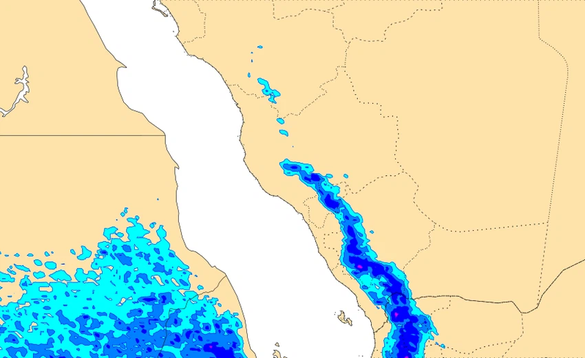
ويتوقع أن تكون شدة الأمطار ما بين خفيفة الى متوسطة الشدة أحياناُ، لاسيما فوق مرتفعات جازان وأبها حيث يتوقع تساقط زخات رعدية بمشيئة الله على تلك المنطقتين.
This article was written originally in Arabic and is translated using a 3rd party automated service. ArabiaWeather is not responsible for any grammatical errors whatsoever.


Arabia Weather App
Download the app to receive weather notifications and more..