Latest updates: A new weather system brings rain to large parts of the Arab East during the first week of Ramadan
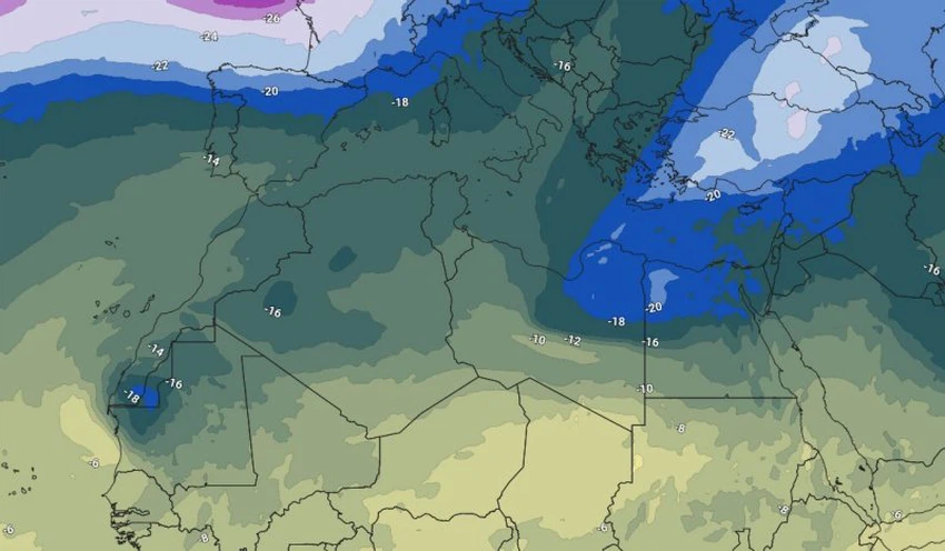
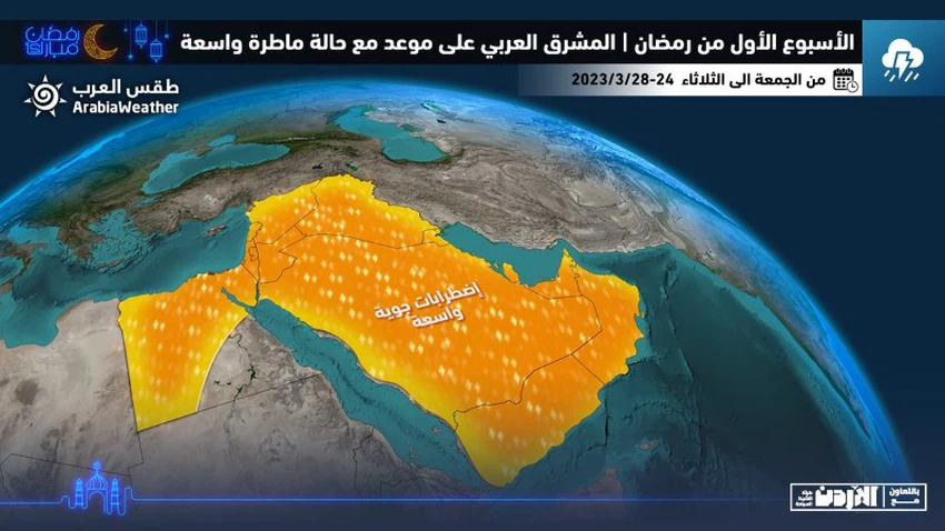
From the Arab Weather Center - The weather indicators received by the "Arab Weather" regional center for weather forecasts increased, indicating that all countries of the Arab East were exposed to a large-scale rainy weather in the first days of the holy month of Ramadan, as a result of the rush of a cold and moist air mass in the upper layers of the atmosphere towards Libyan lands and heading east to the north of the Arabian Peninsula, coinciding with the extension of the Red Sea depression on the surface from the south, and this convergence will lead to the emergence of widespread weather disturbances accompanied by rains that are sometimes thunderstorms, which leads to an increase in the chances of the formation of torrents in several areas at the will of God.
And the data that is received and processed within the corridors of the "Arab Weather" center indicates that the cold and moist air mass in the upper layers of the atmosphere is expected to rush into the central Mediterranean region and provoke the Red Sea depression (Sudan) by expanding towards the north, generating with it a state of instability. The weather affects, starting from the eastern coasts of Libya, and gradually affects large parts of northern Egypt with rainy thunderstorms during the weekend, God willing, which raises the chances of valleys and torrents flowing in those areas.

It is expected that the Levant and northern Saudi Arabia will be affected on Saturday 3-25-2023 by the state of atmospheric instability, with the deepening of cold air in the layers of the atmosphere and its convergence with the extension of the Red Sea depression, so that the opportunity is ripe for thunderstorms of rain, God willing, in separate areas From the Levant. These precipitations may be heavy in some neighborhoods and narrow geographical areas, and are accompanied by hail, which may cause torrential rains in some low areas, slopes, valleys, and reefs.
According to the results of weather analyzes at the Arab Weather Center, it is expected that chances of rain will remain in several parts of the Levant on Sunday, while it will recede in all regions of Egypt. And with the movement of the air system to the east, thunderstorms will affect Iraq, Kuwait, and large parts of the Kingdom of Saudi Arabia, including the eastern and central regions, and parts of the western sector, including Makkah Al-Mukarramah, on the same day.

The same data indicates that during the middle of the next week, March 27 and 28, 2023, it is expected that air disturbances will focus on the areas overlooking the Arabian Gulf basin, including the eastern Kingdom of Saudi Arabia, Kuwait, Bahrain and Qatar, and later the rain will extend to separate areas of the Emirates and the Sultanate of Oman, God willing. Come here.
God knows.
Arabia Weather App
Download the app to receive weather notifications and more..


