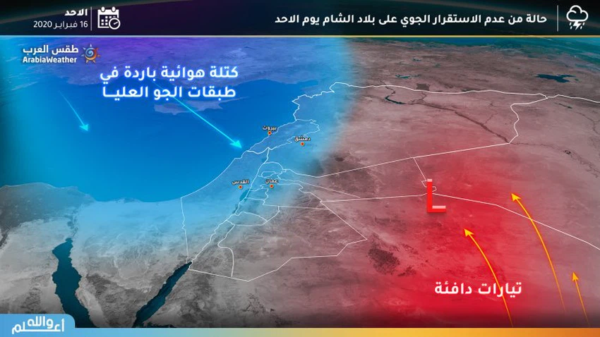
Sunday | A state of air instability gradually affecting the Kingdom ... and expected fog in a number of regions
Weather of Arabia - On Sunday, the kingdom is expected to be affected by a state of weather instability, accompanied by varying intensity of rain in different parts of the Kingdom.
In details , clouds multiply gradually during the day over different parts of the kingdom, and the opportunity is created, God willing, for rain showers, especially during the afternoon and afternoon hours, on random and sporadic parts of the kingdom, especially the southern mountainous regions, which may be accompanied by thunder sometimes .
There is also a decrease in temperatures, to become around their rates for such a time of the year, and the weather will be relatively cold in different regions.
The winds will be moderate to southwesterly to southwesterly, and it will be active in desert areas that may stir dust and dust.
Cold weather at night ... and fog forecasts in highlands, eastern and desert plains
Cold weather generally prevails throughout the regions at night, and the weather is partially cloudy in various regions with the opportunity to showers of rain in limited parts of the south of the Kingdom .
Moisture levels are expected to increase significantly, and fog will form over mountainous heights and eastern and desert plains, especially during the late night and dawn hours .
Arab Weather Recommendations:
- Attention: low visibility due to fog during the late night hours and dawn over the mountainous highlands, eastern and desert plains .
- Attention to the possibility of torrential rains and the flow of some valleys due to the abundance of rain showers locally, especially in the southern mountainous highlands

Arabia Weather App
Download the app to receive weather notifications and more..


