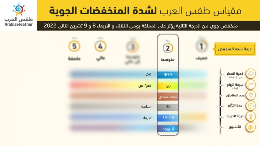
Jordan: The first air depression classified as a second degree affects the Kingdom on Tuesday and Wednesday, accompanied by a decrease in temperatures and rain in various regions
Arab Weather - The latest weather readings of computer simulation models of the movement of air masses indicate that after the rise in temperatures on Sunday, the Kingdom is expected to be affected by an air depression classified as second-class according to the innovative scale of air depressions from Arab weather, which consists of five degrees (the highest intensity The fifth degree and the weakest of the first degree) is expected to affect the kingdom on Tuesday and Wednesday, God willing.

In the details, specialists in the Weather Operations Department at the Arab Regional Weather Center for Meteorology and Weather Forecasts reported that a relatively cold air mass is expected to approach the Kingdom on Monday, so that there is a significant drop in temperatures on Monday and become below their rates for this time of the year by about 2-4 degrees Celsius. It is also expected that the weather will turn into a pleasant autumn in most areas and cold in the high mountainous heights, and the opportunity for sporadic showers of rain will be created, God willing, in parts of the north of the Kingdom.
It is expected that the Kingdom will be affected, as of Tuesday, by a second-degree air depression in all layers of the atmosphere, superficially located off the Lebanese coasts and accompanied by a relatively cold air mass, where there is an additional drop in temperatures, which are several degrees below their rates for this time of the year. The weather is generally cold in most areas, and fluctuates between partly cloudy and cloudy, and rain is expected, God willing, in the north and center of the Kingdom, especially with the morning hours, and fog forms over some high mountainous heights after crossing touching clouds. To the surface of the earth, the chances of rain extend to the south, especially the Karak and Tafila heights, and later towards parts of the northern and eastern Badia. And the east of the Kingdom and may cause dust waves.
And it is expected, God willing, that the Kingdom will be affected on Wednesday by humid western air currents behind the depression. The center of the Kingdom and may extend over time towards the eastern regions of the Kingdom. The weather continues on Wednesday/Thursday night, relatively cold, and the chances of rain are declining in most areas, and the crossing of low clouds touching the surface of the earth continues in many mountainous heights, so that fog forms in some areas, which calls for wearing warm clothes.
God knows.
Arabia Weather App
Download the app to receive weather notifications and more..


