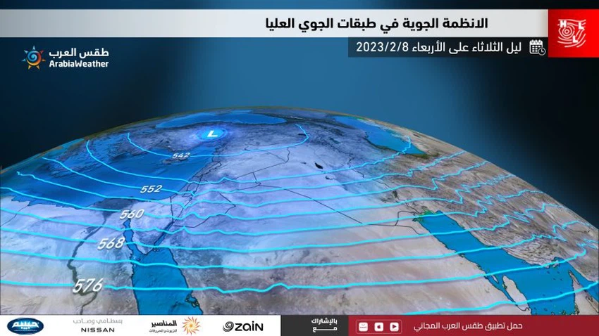
Jordan: Intermittent snowfall is expected tonight and tomorrow above 1000 meters, with its extension at intervals below that, and the accumulations are generally few (know the areas and the chances of accumulation)
Weather of Arabia - The latest weather maps developed internally from Arab Weather indicate that the Kingdom is expected to continue to be affected by the same depression, which is classified as a fourth degree, and the Kingdom gradually crosses a new cold front tonight, causing precipitation to extend towards the governorates of Karak and Tafila, in addition to other areas It also leads to the return of the snowfall level to 1000 meters above sea level, and it decreases at intervals to less than that after midnight.

Snow tonight will be sporadic
It is expected that precipitation, including snow, will be intermittent from time to time, which limits the occurrence of large accumulations in the places where it falls. While it is not excluded that precipitation will be more regular in the governorates of Karak and Tafila, including snowfalls on their heights.
Details of areas covered by intermittent snowfall
And it is expected, God willing, that the snow will return intermittently tonight on the high mountain elevations, which are more than 1000 meters above sea level, which include the heights of the Jerash and Ajloun mountains, such as Ras Munif, Asfour Gap, the base triangle and the peaks of the Suf region and the high surrounding areas in addition to The upper regions of Deir al-Kahf, Umm al-Qattin, Sabha, and Subhiya in the Mafraq governorate adjacent to Jabal al-Arab, and some elevated neighborhoods of the capital, Amman, and al-Balqa, such as Zai, Umm Joza, and the upper regions of Sweileh, Tla’ al-Ali, Jubaiha, the University of Jordan, Dabouq, Abu Alanda, and the regions It also extends with the night hours to include the southern shrine district and Mutah in the Karak governorate, and later to the various heights of the Tafila governorate, such as Upper Al-Ais, Grendel, Al-Qadisiyah and Al-Rashadia.
Snow extends at intervals to less than 1000 meters after midnight and Wednesday morning
And with the hours after midnight and Wednesday morning, and as a result of the crossing of a new cold air front, it is expected that the level of snowfall will decrease intermittently to areas whose height is less than 1000 meters. Few and different from one region to another, depending on the continuity of precipitation and the extent of altitude above sea level.
There are few accumulations in general, except for the heights of Karak and Tafila
According to the results of computer simulations of snow accumulations, they indicate that snow accumulation may be present in some highlands in the north and center of the Kingdom, but the accumulations are generally few when they occur and differ greatly from one region to another, depending on their height above sea level and the continuity of precipitation. While the same results indicate that the heights of Karak and Tafila may have good snow accumulations with the hours of Wednesday morning.
The depression is moving away from the kingdom on Wednesday evening, with the rush of a cold polar air mass behind it
And the latest estimates indicate that the depression will move away from the region with the rush of a polar air mass and the bitter cold behind it, leading to a significant decrease in temperatures and approaching zero degrees Celsius in many regions. The chances and intensity of precipitation gradually decrease with the evening hours, and the weather turns to be severely cold over the mountain heights and very cold in the rest of the regions, with the possibility of freezing, especially in the peaks of the high mountain heights.
And quantities of clouds and low clouds continue to appear, and the opportunity remains ripe for some local showers of rain and snow.
God only knows
Arabia Weather App
Download the app to receive weather notifications and more..


