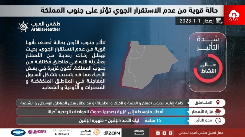
Jordan | A strong state of air instability affecting the south of the Kingdom tonight and Monday morning requires attention from the dangers of sudden torrential rains
Weather of Arabia - weather maps in the Arab Regional Weather Center indicate the progression of a cold air mass in the upper layers of the atmosphere that coincides with the extension of moist air currents in the various layers of the atmosphere originating from the Arabian Peninsula and the Red Sea, where a strong state of atmospheric instability arises, starting from the late night hours From Sunday / Monday night, clouds will multiply at different heights, with showers of rain falling in several parts of the south of the Kingdom.
The rains are sometimes heavy and accompanied by showers of hail, and the rains cover several parts of the south of the Kingdom, especially the southern Badia regions, including the city of Ma’an, Wadi Rum and Al-Jafr, in addition to the Mudawara border crossing and the southern parts of the desert road.
As for the city of Aqaba, chances of thunderstorms of rain include the city of Aqaba sometimes, especially during the middle and after midnight on Sunday / Monday.
The continued high impact of the state of air instability on Monday morning, in the south of the Kingdom
It is expected, God willing, that the weather on Monday will be cold in general, and the southern regions will continue to be affected on Monday morning by a strong state of atmospheric instability, with showers of rain sometimes heavy and accompanied by the occurrence of thunder and showers of hail, but gradually with the late morning hours the momentum of the situation declines Atmospheric instability in the south of the Kingdom, but showers of rain continue to fall in these areas, coinciding with the crossing of low clouds and touching the surface of the earth, leading to the formation of fog over the high mountain heights.

It is expected that the chances of showers of rain will gradually extend with the passage of the day towards parts of the center of the Kingdom, which may reach the Jordan Valley and the Dead Sea, provided that the chances of rain will recede from most areas in the evening and night hours, and the opportunity will remain for local showers of rain in limited parts.
Active easterly winds accompanying a state of atmospheric instability
According to the weather maps of the weather forecast staff at the Arab Regional Weather Center, it is expected that the Kingdom will continue to be affected by active easterly winds tonight and Monday, accompanied by strong gusts that sometimes exceed 70 km / h, especially in the mountainous heights and the Shafa Ghouri and Ghouri regions.
Important recommendations from the Arab weather, especially in the south of the Kingdom:
- Stay away from the stomachs of valleys and streams of torrential rains due to the high risk of their runoff in the south of the Kingdom
- Be aware of the dangers of sudden torrential rains, especially in the southern Badia regions.
- Warning of the occurrence of landslides and rocks on the roads and slopes in the south of the Kingdom.
God knows.
Arabia Weather App
Download the app to receive weather notifications and more..


