Jordan | An air mass that is less hot than normal and humid characteristics leads to significant changes in the weather as of Wednesday evening
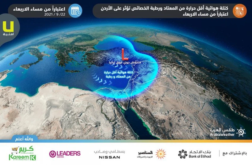
Arab Weather - The latest output of the numerical weather models processed by the Air Operations Department of the Arab Weather Company, indicates that the Kingdom is affected by an air mass with lower temperatures than usual, bringing with it radical and tangible changes to the atmosphere. the details
The beginning of the Kingdom being affected by an air mass with lower than normal temperatures, as of Wednesday evening
The Kingdom’s impact on the air mass begins gradually on Wednesday, especially in the evening hours, so that the temperatures drop to return to their rates for this time of the year, and the weather is moderate in the mountainous heights, hot in the Jordan Valley, the Dead Sea and the city of Aqaba, with the appearance of some low clouds and medium clouds over parts from the kingdom.
Significant drop in temperatures Thursday
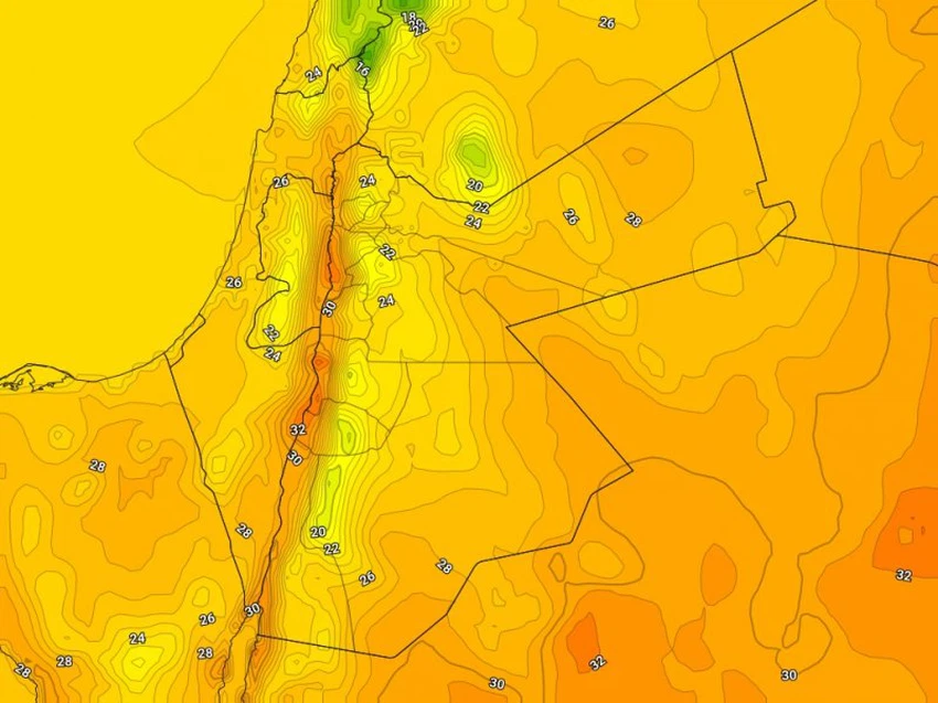
The effect of the air mass increases with lower temperatures than usual, so there is a significant drop in temperatures on Thursday, to become lower than their rates for this time of the year, and the weather is wet and mild autumn in the mountainous heights, relatively hot in the Jordan Valley, the Dead Sea and the city of Aqaba With the appearance of clouds at medium and low altitudes, especially in the northern regions, temperatures return to their twenties levels in most regions of the Kingdom, while they are in the early thirties in the Jordan Valley, the Dead Sea and the city of Aqaba.

An additional drop in temperatures Friday and cold weather in the mountains
The effect of the air mass increases with lower temperatures than usual and reaches its peak on Friday, so that the temperatures drop further, to be much lower than their rates for this time, and the weather is humid and pleasant autumnal to cold over the high mountainous heights, relatively hot in the Jordan Valley , the Dead Sea, Aqaba, and the Badia regions.

Temperatures will be at the beginning of the 20th in the capital, Amman, and in many major cities, especially the mountainous ones, and shifted to below 20 degrees in the Sharah Mountains and the southern high mountainous highlands, with the appearance of quantities of low clouds, especially in the early morning hours.
Relatively cold and foggy nights and cooler Friday/Saturday nights
It is expected, God willing, that night temperatures will drop sequentially as of Wednesday/Thursday night, so that the weather tends to get cold in the mountains and plains during the late night hours, and there will be an increase in humidity and low clouds are formed, working to form fog in parts of the mountainous heights and the eastern plains.
Night temperatures decrease on Thursday/Friday night, especially Saturday/Sunday night, so that the weather is cooler than it is used to in most regions of the Kingdom, especially the high mountainous heights, and humidity levels rise significantly, with the appearance of large amounts of low clouds, and fog formation Dense over the high mountainous elevations and the eastern plains.
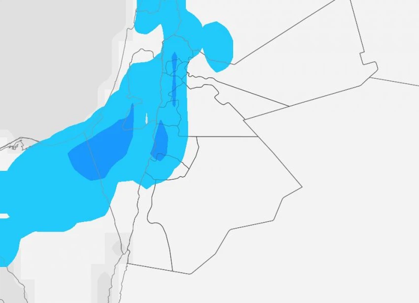
A chance of scattered showers of rain in the north and center of the Kingdom, in addition to the Sharah Mountains
The outputs of the numerical weather models and as a result of the increase in the density of low clouds in the atmosphere indicate that there is a possibility of scattered showers of rain in parts of the north and center of the Kingdom, all the way to parts of the peaks of the Shara Mountains, starting from the late night hours of Thursday/Friday night and the dawn of Friday, Until the daylight hours on Friday, the first chances of rain are expected for the current autumn season.
![]()
Active winds accompanied by strong gusts on Wednesday and Thursday
Westerly to northwesterly moderate winds of active speed will blow over the Kingdom on Wednesday and Thursday, especially on Thursday. Active winds are accompanied by strong gusts that touch the 60 km/hour barrier over some regions of the Kingdom, causing dust and dust in desert and open areas.
Important recommendations from Arab weather
- Pay attention to temperature differences and increase the chances of infection in the coming days
- Warning for respiratory patients of complications due to dust and dust raised Wednesday and Thursday
- It is recommended to wear a light coat when leaving the house during the late night and early morning hours
For more news, download the Arabia Weather app from here
God knows.
Arabia Weather App
Download the app to receive weather notifications and more..


