Jordan | A second-degree air depression begins its direct effects on Tuesday / Wednesday night
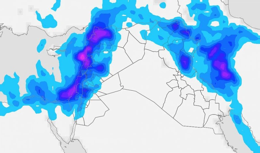
Arab Weather - A cold air front begins to cross the Kingdom's airspace on Monday evening, as the atmosphere becomes unstable in many regions, and medium, high and cumulus clouds proliferate, and thunderstorms of rain fall in some areas, especially the southern ones, where the opportunities for rain include the city of Aqaba.
Temporary stability on the weather on Tuesday
The cold air front moves away from the Kingdom on Tuesday, and the weather tends to stabilize slightly, with the continued blowing of the active-speed southwesterly winds, and a significant and tangible drop in temperature compared to Monday, and quantities of dust are dispersed in the air that reduce the horizontal visibility.
The center of the depression is approaching the Kingdom, and the return of rain will start on Tuesday / Wednesday night

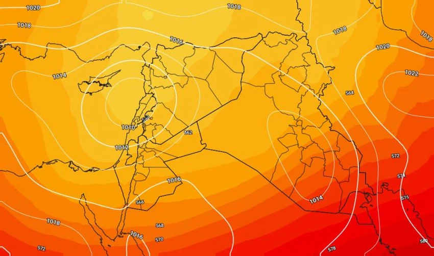
With the hours of Tuesday evening, the depression, which was classified as second-degree according to the Arab weather scale to classify the severity of the depressions, is centered south of the island of Cyprus and moves east towards the coast of Lebanon, and large quantities of accompanying clouds begin to enter the atmosphere of the Kingdom with the hours after Midnight Tuesday / Wednesday, and rain begins in the north of the Kingdom, and then gradually includes the center and south of the country and parts of the eastern region on Wednesday.

Temperatures will be recorded further on Wednesday, when cold and rainy weather prevails during the day, with fog forming over high mountain peaks due to clouds touching the surface of the earth
Arabia Weather App
Download the app to receive weather notifications and more..


