Algeria | A hot air mass is rushing towards the republic in conjunction with unstable weather conditions in many areas next week
Arab weather - Weather updates still indicate that Algeria will be affected next week by a hot air mass coming from the Algerian desert, in conjunction with the emergence of unstable weather conditions in parts of the Republic of Algeria.
A hot air mass is rushing towards Algeria
There is an increase in temperatures during the week, as a result of building a strong air rise in all layers of the atmosphere in the northwest of the African continent, to become 4-6 degrees Celsius higher than their rates for this time of the year; This makes the weather relatively hot to hot in the northern parts and very hot in the rest of the regions.
During the night hours, a warm atmosphere prevails in most of the central and southern regions, while it may tend to be cool in the late night hours in the northern regions, including the coastal ones. The surface humidity levels also rise and light fog forms on the northern parts that may extend to some coastal areas.
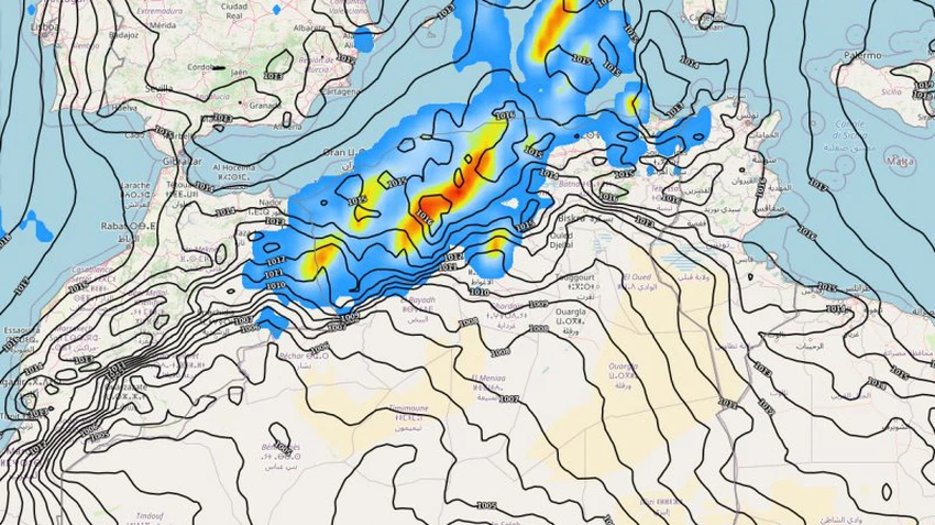
Unstable weather conditions in many areas
Algeria is affected by a state of atmospheric instability; As a result of the progress of an upper air depression in the upper layers of the atmosphere and an extension of a temperature depression in the Algerian desert on the surface layers, and gradually quantities of medium and high clouds appear over large parts of the country and the opportunity is created with the noon and evening hours on a daily basis for showers of thunderstorms in separate and random parts of Algeria. It is abundant locally or in some narrow geographical areas, especially the northern and western regions.

It is expected that these rains will be accompanied by a great activity of surface winds that are expected to cause local sandstorms and reduce horizontal visibility in desert areas. Winds will be southeasterly to easterly moderate in speed, active at intervals, but they may be accompanied by strong flashes during the passage of clouds thunderstorm cumulus;
In this climate, Arab Weather warns of the need to adhere to the following instructions:
- Avoid direct exposure to sunlight for long periods, and not exerting physical exertion, especially in the afternoon and afternoon hours.
- Drink plenty of cold fluids and refreshments throughout the day.
- Warning of the formation of torrential rain in valleys and low-lying areas.
Arabia Weather App
Download the app to receive weather notifications and more..


