A strong state of atmospheric instability affects Iraq, accompanied by strong thunderstorms, which requires attention from torrents and floods.
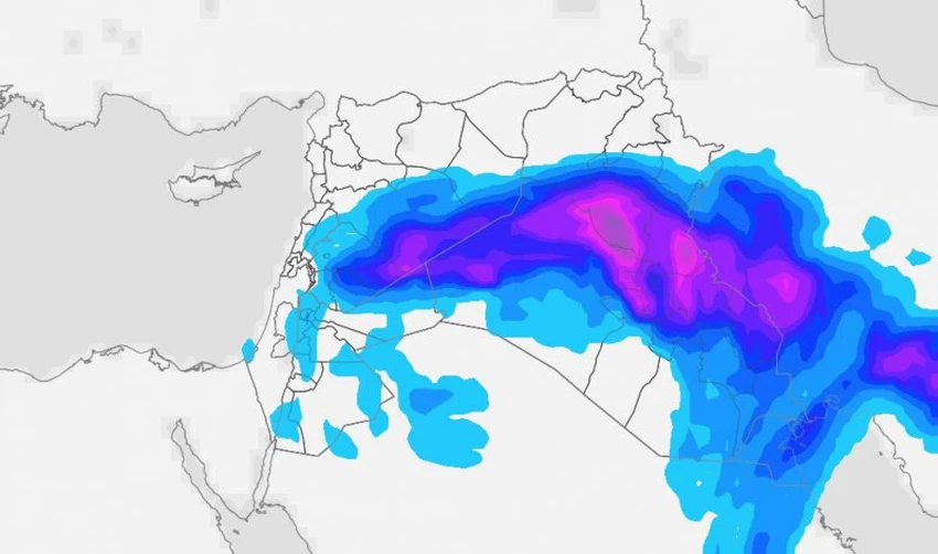
Arab Weather - Weather maps at the Arab Weather Regional Center indicate that Iraq will be affected by a moderate to strong state of atmospheric instability on Wednesday and Thursday, continuing on Friday, resulting from the convergence of a cold air mass in the upper layers of the atmosphere, with a surface extension of the Red Sea depression. This convergence leads to the proliferation of cumulonimbus clouds and the fall of thunderstorms in several areas of the country.
In detail, during the daytime hours of Wednesday, a state of atmospheric instability will arise, as clouds gradually multiply at different heights during the daytime hours, and God willing, showers of rain will fall on scattered areas of Iraq, concentrated in the southern and central parts of Iraq, including the capital, Baghdad. The rain will sometimes be heavy in some geographical areas, accompanied by showers of hail with thunderstorms, which may lead to a rise in water levels in some areas and the occurrence of water pools.
During the day on Thursday, the impact of the instability will gradually recede from most areas of Iraq, with rain then concentrated in the southern regions, accompanied by thunderstorms before expanding again at night.
The state of atmospheric instability will intensify in Iraq at midnight on Thursday/Friday and during the day on Friday
According to the weather maps at the Arab Weather Regional Center, the depression is expected to deepen in the upper atmosphere at midnight on Thursday/Friday and during the day on Friday, and with it the unstable weather conditions will intensify in several areas, as showers of rain will fall, God willing, in many areas, but they will be concentrated in the middle of the country. The rain will be heavy at times and accompanied by heavy showers of hail with strong thunderstorms and activity in the speed of surface winds, and there is a fear of the risk of floods and rising water levels in some areas, and it also warns of the flow of valleys and ravines as a result of heavy rain.
Important recommendations from Arab Weather during unstable weather conditions:
- Stay away from valleys and torrents due to the high risk of flooding, especially after midnight on Wednesday/Thursday.
- Beware of the risks of rising water levels, water pools and traffic jams.
- Take shelter indoors during thunderstorms.
God knows best.


Arabia Weather App
Download the app to receive weather notifications and more..