Satellite imagery of NASA monitors the largest sandstorm on Earth

2020-06-28 2020-06-28T16:14:31Z
وداد السعودي
وداد السعودي
محرر أخبار جوية- قسم التواصل الاجتماعي

Weather of Arabia - NASA's satellite imagery detected a huge sandstorm moving over the Gulf of Mexico and spread to Central America and over a part of the eastern Pacific Ocean coming from the African desert.


And NASA indicated that the sandstorms from the Sahara desert across the Atlantic are not new, but what distinguishes this storm, which some called "Godzilla", is huge and very wide.
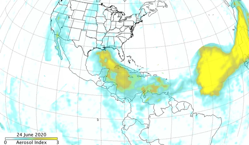
 

On June 18, captured images showed that the thicker parts of the massive dust storm extend 2,500 kilometers (1,500 miles) across the Atlantic Ocean. But by June 24, the column spanned more than 5,000 miles .
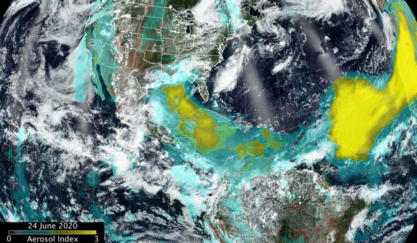


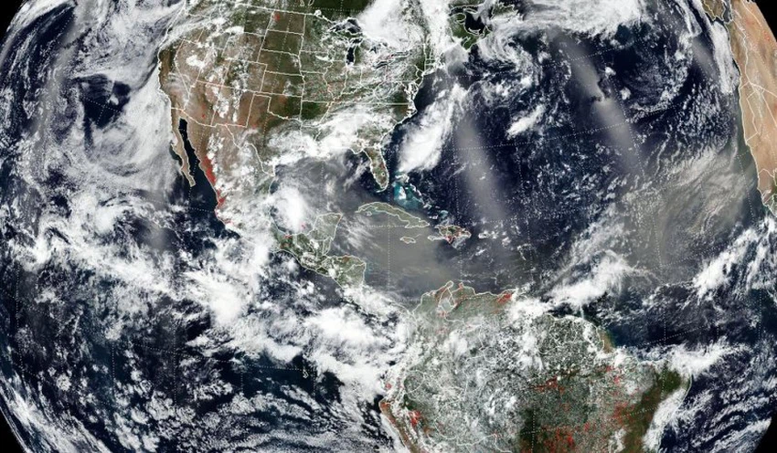
A huge sandstorm heads from Africa towards the Gulf of Mexico, crossing more than 5,000 miles over the ocean


NASA indicated that dust from Africa can affect air quality in remote regions such as North and South America, but dust can also play an important environmental role, such as fertilizing soil in the Amazon and building beaches in the Caribbean.


The dry and warm conditions and winds associated with the desert stratification from Africa can also prevent the formation and intensification of tropical cyclones .


This article was written originally in Arabic and is translated using a 3rd party automated service. ArabiaWeather is not responsible for any grammatical errors whatsoever.
See More
Related News
Rainstorm and heavy rainfall expected in southern Europe at the end of the week

Rainstorm and heavy rainfall expected in southern Europe at the end of the week

European continent An air force imposes its control over western and central Europe

European continent An air force imposes its control over western and central Europe

The chances of the region being affected by colder air masses are increasing, with the chances of low pressure systems forming in the second half of the month increasing (details)

The chances of the region being affected by colder air masses are increasing, with the chances of low pressure systems forming in the second half of the month increasing (details)

What is the tag and when does it start for the year 2024/1446?

What is the tag and when does it start for the year 2024/1446?