طقس العالم | الإعصار Hagibis يتراجع للدرجة الأولى وعين الاعصار تقترب من طوكيو

2019-10-12 2019-10-12T08:03:27Z
أريج الدجاني
أريج الدجاني
محرر أخبار جوية - قسم التواصل الاجتماعي

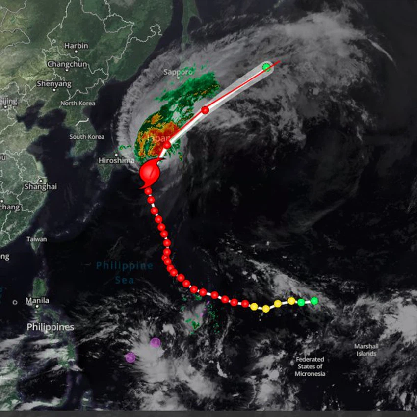
طقس العرب - يتمركز الاعصار Hagibis على بعد 140 كيلومتر جنوب شرق العاصمة اليابانية طوكيو،

حيث يُصنف على انه اعصار من الدرجة الاولى بحسب آخر التحديثات وتبلغ سرعة الرياح حول عين الاعصار 80 عقدة.

ويتحرك باتجاه شمال شرق مع توقعات بأن تعبر عين الاعصار العاصمة طوكيو مع ساعات المساء بتوقيت مكة المكرمة


الاعصار hagibis

This article was written originally in Arabic and is translated using a 3rd party automated service. ArabiaWeather is not responsible for any grammatical errors whatsoever.
Plus
Related News
A very cold air mass of polar origin is located in eastern Europe, pushing its cold winds to the Levant.

A very cold air mass of polar origin is located in eastern Europe, pushing its cold winds to the Levant.

Bringing spring snow to mountain peaks, a cold air mass is affecting the eastern Mediterranean and the Levant, accompanied by radical changes in the weather (details)

Bringing spring snow to mountain peaks, a cold air mass is affecting the eastern Mediterranean and the Levant, accompanied by radical changes in the weather (details)

Weather conditions and sky conditions in the Arab world at the time of observing the crescent of Shawwal 1446 AH

Weather conditions and sky conditions in the Arab world at the time of observing the crescent of Shawwal 1446 AH

Weather and temperature fluctuations are coming to the Arab world, with chances of rain in several countries coinciding with Eid al-Fitr.

Weather and temperature fluctuations are coming to the Arab world, with chances of rain in several countries coinciding with Eid al-Fitr.