Urgent Warning of torrential rain due to heavy thunderstorms in the northern and central Jordan Valley

2020-02-19 2020-02-19T11:23:36Z
وداد السعودي
وداد السعودي
محرر أخبار جوية- قسم التواصل الاجتماعي

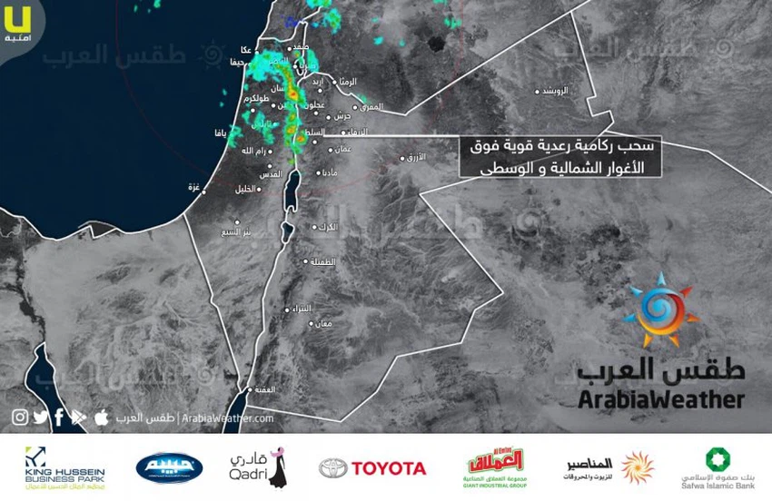
Arab Weather - Northern and central Jordan Valley areas are exposed to heavy thunderstorms as a result of cumulative clouds crossing over these areas. And the weather of the Arabs recommends attention from the risk of torrents and flow of wadis.


It is noteworthy that the Kingdom has been affected since Tuesday night by a state of air instability


This article was written originally in Arabic and is translated using a 3rd party automated service. ArabiaWeather is not responsible for any grammatical errors whatsoever.
See More
Related News
Mild, spring-like weather through Tuesday, preceded by a rainy, stormy depression (to be classified later) starting Wednesday.

Mild, spring-like weather through Tuesday, preceded by a rainy, stormy depression (to be classified later) starting Wednesday.

Starting Wednesday, February 5, 2025: A winter system reaches the region for the first time this winter, resulting in a classified low pressure system followed by a cold wave.

Starting Wednesday, February 5, 2025: A winter system reaches the region for the first time this winter, resulting in a classified low pressure system followed by a cold wave.

A regional winter system will include several countries in the Eastern Mediterranean starting next Wednesday, God willing.

A regional winter system will include several countries in the Eastern Mediterranean starting next Wednesday, God willing.

Stormy and rainy air depression affects the Gaza Strip and the risk of sea waves entering the land increases

Stormy and rainy air depression affects the Gaza Strip and the risk of sea waves entering the land increases