City of Jeddah | Indications of the high chances of developing a rainy situation during the coming period

Arab Weather - The latest outputs of numerical models in Arab Weather indicate an improvement in the chances of developing a rainy situation in Jeddah during the medium-term period, as according to the readings of most numerical models, the central Red Sea will respond to the cold air masses descending towards the eastern Mediterranean and the northern Red Sea During the third and last week of November.
Chances of rain showers start on Friday
Numerical models still indicate opportunities for showers of rain in the city of Jeddah on Thursday / Friday night and Friday morning, as a result of marine excretions and cumulonimbus clouds that are expected to form at sea, moving towards the city gradually.
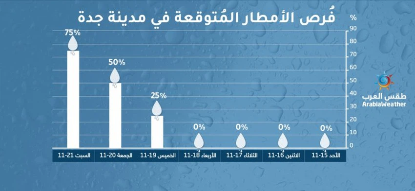
However, during the next week, the chances of rain will increase and improve stronger in the city of Jeddah as a result of the continuous flow of cold air masses in the high air layers over the eastern Mediterranean and the northern Red Sea, where the central Red Sea will become the meeting point of these cold and warm masses from the south. .
What will support the development of the rainy situation is the arrival of large quantities of moisture related to the tropical state in the Arabian Sea, which is expected to form during the end of this week.


Arabia Weather App
Download the app to receive weather notifications and more..