A radical change in the weather: A cold air mass will affect Egypt starting Wednesday, bringing strong winds and a sharp drop in temperatures.
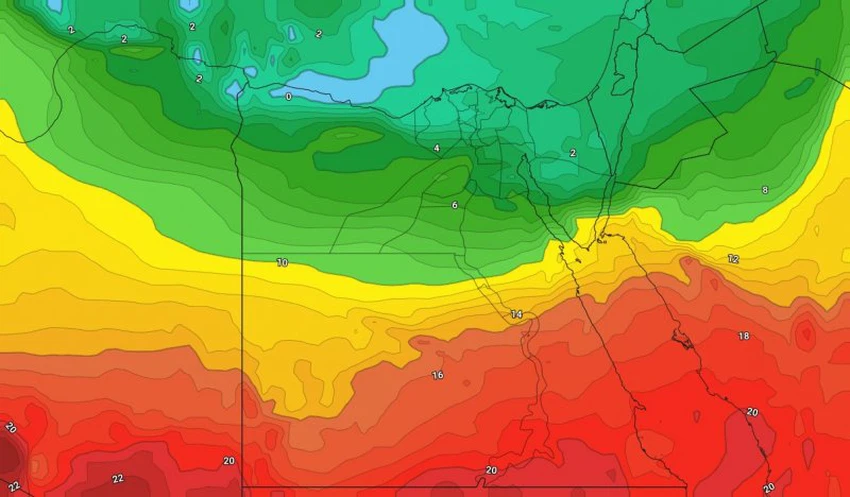
Arab Weather - According to the latest weather map readings from the Arab Weather Center, forecasts indicate that an extremely cold air mass will sweep across eastern Europe toward the Mediterranean Sea. This will lead to the formation of a low-pressure system around Cyprus, south of Turkey, and will affect Egypt at the end of the week as an extension of the low-pressure system accompanied by a cold air mass.
A sharp drop in temperatures with active winds and chances of rain.
Temperatures are expected to continue to gradually drop as the cold air mass approaches, starting Tuesday. The effects of the cold air mass will begin on Wednesday, when temperatures will drop, with active to strong winds blowing at sea and clouds spreading at various altitudes. Scattered showers of rain will fall at spaced intervals in various areas of the North Coast.
With the arrival of the air mass at the end of the week, temperatures will further drop sharply on Thursday and Friday. Relatively cold weather will prevail in the northern regions, including the capital, Cairo, and cloud cover will spread at higher altitudes.
Strong winds accompany the effects of the cold air mass, especially on Wednesday.
Due to atmospheric pressure differences, brisk northwesterly winds are expected to blow across the northern regions, accompanied by strong to sometimes severe gusts exceeding 60 km/h on Wednesday.
On the sea near the coast, the winds will be strong, reaching speeds of around 50 km/h, accompanied by strong gusts approaching 80 km/h, which will naturally lead to severe disturbance of the sea waves near the coast and in the depths, with waves reaching heights of more than 3 meters.
Important recommendations from Arab Weather:
- Beware of the dangers of strong winds in the northern regions, especially on Wednesday.
- Avoid going to the sea when the sea waves are very rough.
- Wear heavy winter clothes to cope with the expected cold weather.
And God knows best.


Arabia Weather App
Download the app to receive weather notifications and more..