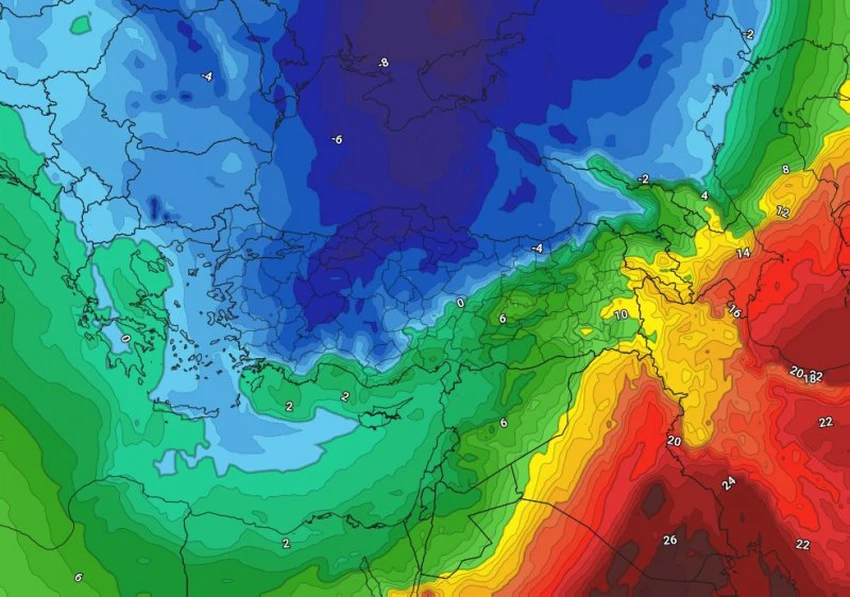
A spring snow wave is affecting Türkiye and eastern Europe, with temperatures dropping to minus 13 degrees Celsius in some areas.
Arab Weather - Meteorologists at the Arab Weather Regional Center said that the latest readings from computer simulations indicate the formation of a strong high pressure system across large areas of the European continent, leading to the surge of an extremely cold air mass of polar origin toward eastern Europe by the end of this week.
A spring snow wave is affecting Türkiye and eastern Europe.
The polar air mass is expected to be accompanied by a rush of large amounts of moisture, leading to heavy rains that will quickly turn into snow across all mountainous areas, including parts of coastal regions. Polar winds flowing behind the low-pressure system will lead to widespread snowfall in most Turkish cities, especially in the central, northern, and eastern regions. Heavy snow is expected at times, resulting in significant snow accumulations in the spring.
Temperatures drop to record and unprecedented levels
As polar winds continue to flow towards eastern Europe, temperatures are expected to drop below zero degrees Celsius over large parts of the country by the end of the week, while temperatures will approach zero degrees Celsius in coastal areas. The cold will deepen significantly during the night and dawn hours, causing temperatures to plummet to a record low of 10-13 degrees Celsius, especially in the eastern parts and high mountainous areas.
And God knows best.


Arabia Weather App
Download the app to receive weather notifications and more..