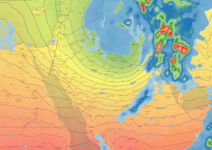
Again, instability in many parts of Saudi Arabia is at the forefront of a cold wave
Arab Weather - rush on Friday a cold air mass in the various layers of the atmosphere coming from Iraq and the Levant towards the north of Saudi Arabia, Kuwait and the north of the Arabian Gulf, is renewed on their impact chances of rainfall on the northern region , and the Eastern and Central of the Kingdom.
As an explanation of the air system that will control the Arabian Peninsula and surrounding areas, a cold air depression is stationed over Iraq, pushing a cold air mass towards Bilad al-Sham and then towards northern Saudi Arabia, coinciding with the control of a relatively warm and humid air mass over central and southern Saudi Arabia.

The convergence line of cold and warm air will be the appropriate environment for the development of thunderstorm clouds as the line of convergence of the two air blocks from Al-Jawf and Northern Borders to Hafr Al-Batin, Sharqiyah, Hail and Qassim.It arrives in the capital Riyadh on Saturday evening, where showers showers.
All in all, the expected weather is weak to moderate in some limited areas, and will be quick-impact and fade on Monday.
It is noteworthy that the chance of frost formation in parts of the region of Jouf and the northern border and Hail will be high morning and early Sunday.
Arabia Weather App
Download the app to receive weather notifications and more..


