Egypt | A significant drop in temperatures and wind activity in northern Egypt on Monday
Weather of Arabia - A significant decrease in temperatures occurs as a result of the northwesterly currents rushing from the Mediterranean to the various regions, to become slightly higher than their rates for such a time of the year, so that moderate weather prevails on the northern coasts and hot on the delta, Greater Cairo, the cities of the Canal, and the middle and north Sinai and the coasts of the Red Sea and northern Upper Egypt are very hot in the rest of the regions, while mild to moderate weather generally prevails during the night hours.
Stable weather in all regions
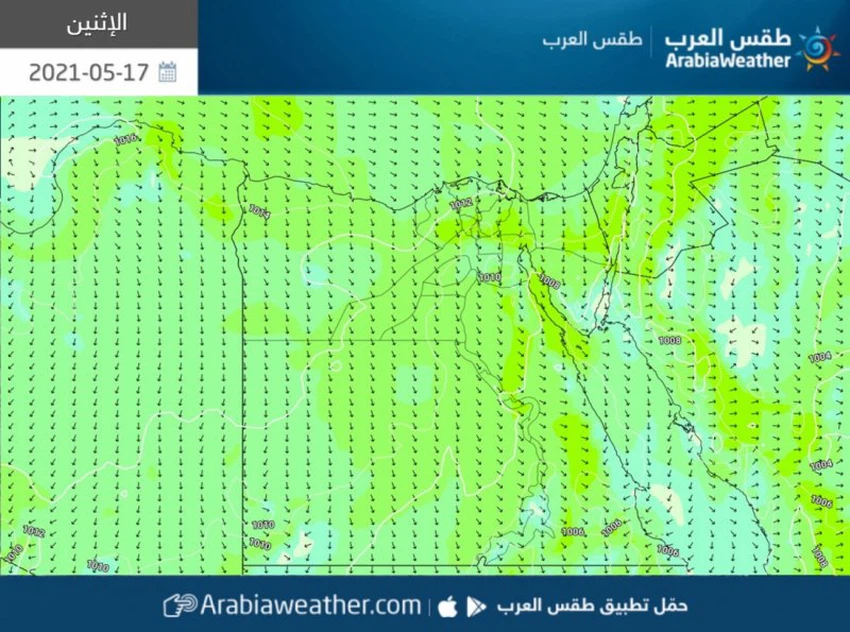
Active winds in northern Egypt
The effect of the upper altitude recedes over Egypt, which contributes to a decrease in temperature over all regions of the republic, while a surface air high is concentrated in the average, which means a rush of northwesterly winds towards the region, so that the winds are light to moderate in speed, sometimes active on parts of the eastern regions and the coasts The Gulf of Suez, Greater Cairo and northern Upper Egypt are dusty and dusty in southern Egypt, and scattered clouds appear at high altitudes, especially in the north of the republic.

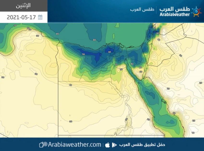
Chances of fog formation in the northern parts
With the hours of the night and early morning
The chances of fog forming on Monday / Tuesday night and Tuesday dawn increase, as surface humidity rises and fog is forming on parts of North and Central Sinai, Beheira, Matrouh and Suez, and it may extend to some coastal areas.

The state of the Red Sea and the Mediterranean
A turbulent sea and the rising waves of the Mediterranean
The waves are medium to high in the Mediterranean and Red Seas, and reach a maximum height of two meters, which may cause partial disruption of navigation and some marine activities, especially in the Gulf of Suez.
Important recommendations that are recommended to be taken seriously:
A set of important recommendations that must be taken seriously in dealing with such an atmosphere can be summarized as follows:
- Avoid exposure to the sun, especially during the afternoon and afternoon hours, especially in the southern regions.
- Drink plenty of cold fluids and soft drinks throughout the day.
- Be careful not to leave sterilizers and any flammable materials inside the vehicles.
- Be careful not to leave children inside the vehicles, even for a few short periods.
- The risk of a decrease in the horizontal visibility due to dust and dust in some southern areas.
- Risk of additives in patients with respiratory tract and eyes due to dust.
- The risk of reduced horizontal visibility due to fog and clouds touching the surface of the earth in parts of the northern regions.
Arabia Weather App
Download the app to receive weather notifications and more..


