Egypt weather: winter temperatures await the republic from Friday 11-03-2022
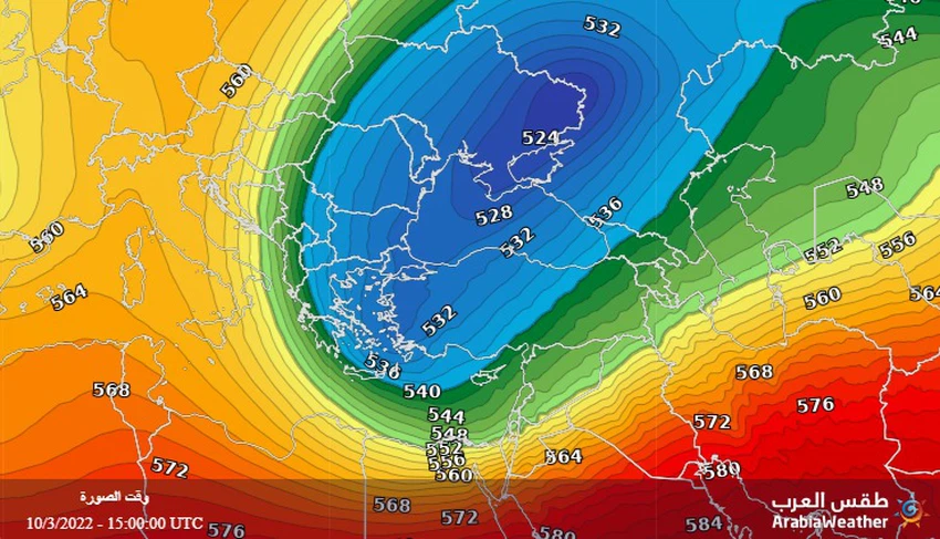
Arab weather - computer modeling maps indicate expectations of a cold air mass rushing into Egypt's airspace from Friday, so that temperatures drop dramatically and clearly, humidity levels rise, and the concentration of dust in the atmosphere decreases.
Winter temperatures from Friday
An air mass that stays near the area for a short period of time
In the details, an air rise attached to a warm air mass from Africa rushed towards the European continent, so that the rise simplifies its control over large parts of the western and central European continent and extends to the northern parts of it to the Scandinavian countries, and this coincides with the rush of a cold air mass that pushes the height to fall to Eastern and Southeast Europe and the Balkans Basin, and it affects all countries of the eastern basin of the Mediterranean, starting on Friday, and continues to affect the atmosphere of the region for quite some time.

It is expected that the temperatures will be cooler than their averages for this time of the year by about 6-8 degrees Celsius, and the weather will be cold in the northern regions and cold in southern Upper Egypt, and often cloudy with the possibility of scattered showers of rain in parts of the northern coast. The winds are northwesterly active, and the Red Sea and the Mediterranean Sea are remarkably rough.
Arabia Weather App
Download the app to receive weather notifications and more..


