Infographic: Learn about snowfall and snowfall areas on Tuesday
2020-01-20
2020-01-20T17:26:30Z
Weather of Arabia - The Kingdom is affected from Monday morning until Wednesday morning, with an air depression classified as second degree according to the scale of severity of the depressions, accompanied by a very cold and arctic air mass that rushes to the region, specifically the Badia Al-Sham region. And the impact of this low air is associated with rain and snow, and remarkably low temperatures.
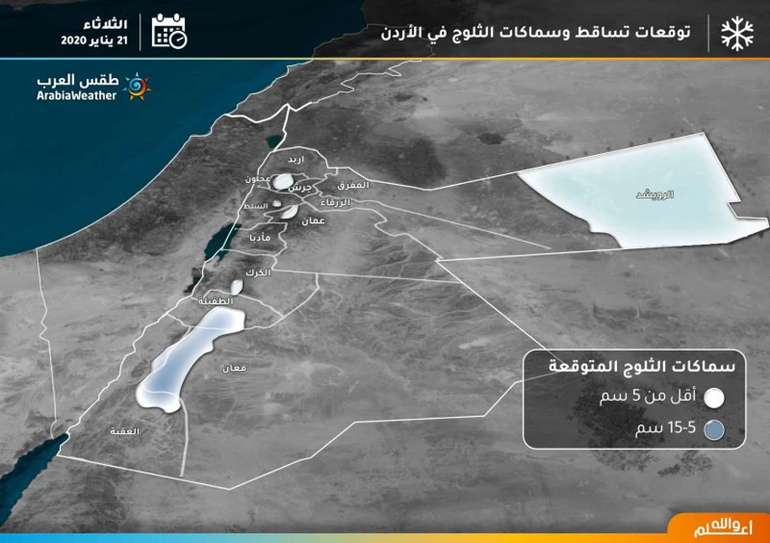
The following infographic shows areas of snowfall and their accumulation on Tuesday
This article was written originally in Arabic and is translated using a 3rd party automated service. ArabiaWeather is not responsible for any grammatical errors whatsoever.


Arabia Weather App
Download the app to receive weather notifications and more..