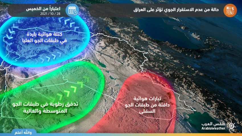
Iraq | Indications of a state of atmospheric instability as of Thursday, and its impact is increasing by the end of the week
Arab Weather - The latest outputs of the numerical weather models processed by the Air Operations Department at the Arab Weather Center indicate that there are indications that Iraq has been affected, as of Thursday, in a state of atmospheric instability, so quantities of clouds appear at different altitudes, interspersed with cumulus clouds that work on thunder showers. Of the rain in narrow and random geographical ranges, and it is not excluded that the showers are sometimes heavy in narrow geographical ranges.
Indications indicate the increasing impact of a state of air instability at the end of the week
According to the processed initial computer outputs, there are initial indications of an increase in the impact of a state of atmospheric instability on the country with the weekend, as the amounts of clouds increase in the atmosphere, and thunderstorms of rain fall on random areas, especially in the eastern regions, these rains are sometimes heavy. In narrow geographic ranges, which may cause the formation of torrential rain and high water levels on the roads.
Atmospheric instability caused by moist air currents

The reason for the presence of indications that Iraq is affected by a state of atmospheric instability at the end of the week is due to the presence of a cold air mass in the upper layers of the atmosphere, with a hot air mass in the lower layers of the atmosphere, coinciding with the rush of large amounts of moisture in the middle and high layers of the atmosphere , works on this convergence on the emergence of unstable weather conditions, God willing.
For more news, download the Arab Weather app from here
God knows.
Arabia Weather App
Download the app to receive weather notifications and more..


