Jordan | A hot air mass is approaching the Kingdom and the return of high temperatures as of Wednesday

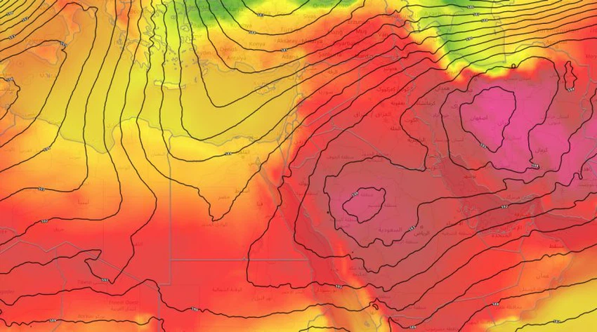
Arab Weather - The latest weather readings of computer simulation models of the movement of air masses indicate an expected approach to the hot air mass on Jordan, starting from Wednesday, as the Kingdom during the summer months is under conflict and overlap between the influence of hot masses centered on the Arabian Peninsula and the extension of the pleasant heat masses rushing across the Mediterranean, the effect of one mass over the other depends on the distribution of the atmospheric systems in the northern hemisphere.
Heat rise from Wednesday
In the details, and according to weather maps, the semi-tropical air altitude will remain concentrated near the western parts of the Arabian Peninsula, which means that its influence will extend to dominate Jordan’s airspace, which means a rise in temperature on Wednesday and even an increase on Thursday in the Kingdom, where relatively hot weather prevails in The mountainous heights, while the weather is very hot in the Jordan Valley, the Dead Sea, Aqaba and the Badia regions, and the temperatures are forty in those areas, and the winds are west to northwest, moderate in speed, active in the afternoon may work on high levels of dust in the atmosphere, especially the interior regions of the eastern Badia.
During the night hours, the weather is moderate in the mountainous heights and the plains, while it is remarkably warm in the low areas, in conjunction with the continued high levels of humidity at night, and the winds will be northwesterly light in general.
Arab weather advises citizens not to direct and prolonged exposure to the sun, especially during the noon and afternoon hours, and to avoid exerting physical effort during the peak heat hours, i.e. between 11 am and 5 pm, in order to avoid sunstroke.
According to the latest weather updates, the hot weather is not expected to decline at the end of this week, which means that the relatively hot weather will continue to be hot in various regions of the Kingdom, and moderate to warm weather prevails in general during the night hours, and despite expectations that temperatures will rise in the coming days, it is not It is expected to rise to what is called scientifically the heat wave, as expectations indicate that the temperatures will not exceed their natural rates much.


Arabia Weather App
Download the app to receive weather notifications and more..