Jordan | Distinctive air activity extending from the middle of the month and for a period of at least a week, including several depressions
Muhammad Aouina - Numerical models a few days ago indicated beautiful signs that began to be drawn by some numerical models, which delight the soul and give us hope, as some models indicated the possibility of the Kingdom being exposed to a highly effective air depression accompanied by a polar air mass of origin, not only that some of them began to explicitly indicate its development To more than that, numerical models differ according to the shape and position of the elements of the prospective system.
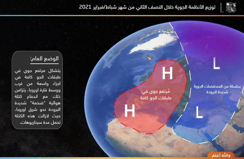
This comes as a result of the location of an air height in all layers of the atmosphere in important areas of the western and central European continent. This coincides with the location of a very cold "huge" air mass in eastern Europe, which allows this system to push very cold polar winds towards large parts of the eastern sea. The Mediterranean, including the Kingdom.
Numerical models need two days to resolve the path of this expected air mass, as the numerical models are still clearly floundering due to the relatively long period, with reference to the importance of following up on the issued reports.
The Kingdom is experiencing a state of air stability and temperatures higher than their usual rates for such a time of year, and the weather is warmer than usual for this time of the year in most regions and relatively hot in the Jordan Valley, the Dead Sea and Aqaba, which makes the atmosphere suitable for trips, especially in the Dead Sea and Aqaba, The weather will continue as it is until next Monday, God willing.

For professionals and those interested:
Some computer models indicate an excessive expansion of the air altitude towards the regions of Scandinavia to the island of Greenland, with a weakness in the base of the altitude stationed over Italy, which directly affects the flow of the mass, in addition to the activity of the Atlantic storms towards the British Isles, which is a killing point for the Levant. These combined weather factors weaken the momentum of the polar eruption towards the southern Levant.
ArabiaWeather Company shall not be responsible for any republication. The materials published in the “Arabia Weather Blogs” in the various media, which puts anyone who publishes these blogs in the name of the Arabia Weather or quoting the Arabia Weather under liability and legal accountability.
Arabia Weather App
Download the app to receive weather notifications and more..


