Jordan | Unstable weather conditions on Monday evening in the introduction to an air depression affecting the Kingdom on Wednesday
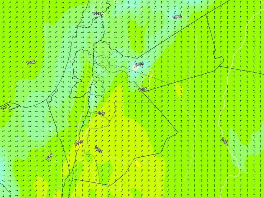
Arab Weather - The Kingdom is affected on Monday by a warm air front in the front of an atmospheric depression that is gradually approaching the Kingdom, where an atmosphere is warmer and warmer than usual with the emergence of high clouds, and the Kingdom is blown by high-speed southwesterly winds loaded with proportions of dust and dust, especially in the afternoon. Strong gusts in the southern regions may reach 80 km / hour, which leads to the formation of dust waves in the southern and eastern badlands, and the sea waves rise dramatically in the Gulf of Aqaba.

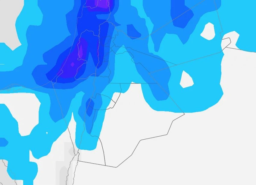
Gradually during the evening and night hours, the Kingdom is affected by unstable weather conditions as a result of crossing a cold air front, as clouds multiply at different heights and thunderstorms of rain fall in random areas including the city of Aqaba, and the rains of varying intensity and abundance in narrow geographical ranges without others, which work On the formation of flash floods.
Temporary stability on the weather on Tuesday, and an air front accompanying an air depression that affects at night!
The temperatures decrease on Tuesday and the weather is relatively cold in general, with the appearance of clouds at different heights, especially in the north of the Kingdom, and gradually during the late hours of the night and the dawn hours, the Kingdom begins to be affected by the air depression classified as a second degree (normal), and it crosses a rainy air front causing rain Starting from the northern regions, it extends during the late hours of the night towards the central regions and may affect some southern regions, and the rains of varying intensity intensify in some areas, with fog forming over the mountain heights and the plains.
The kingdom will continue to be affected by the air depression during the day, with an additional decrease in temperatures and precipitation in different regions of the Kingdom, God willing.

⚠️ Recommendations
1- Pay attention to the large temperature differences between Monday and Tuesday.
2- Not to approach the stomachs of valleys, streams of torrents and reefs.
3- Paying attention to respiratory patients from the risk of complications due to the increase in dust levels in the air.
4- Attention to the danger of high waves in the Gulf of Aqaba.
God knows.
Arabia Weather App
Download the app to receive weather notifications and more..


