Jordan Weekly Newsletter | A warm African air mass at the weekend and drastic changes to the air systems are expected at its end
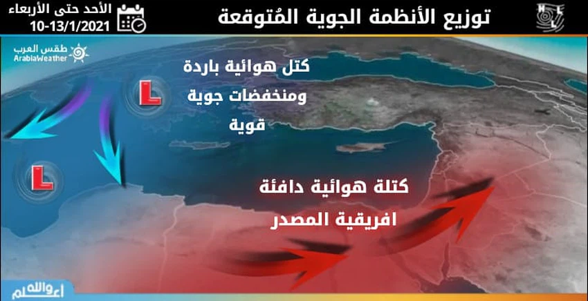
Weather of Arabia - As a result of the approaching of a warm mass rushing from the African continent, an escalating rise in temperatures occurs on Sunday and Monday, and a warm atmosphere prevails during noon hours over most regions, with the south-eastern winds continuing to blow light to moderate in speed, and the weather remains cold in hours Night over all regions, with high levels of humidity in the valleys and the southern desert.

The African air mass reaches its peak in the middle of the week and twenty temperatures in most regions!
The warm and unusual African air mass for this time of year reaches its peak on Tuesday and Wednesday, when there is a clear rise in temperatures, and a warm atmosphere prevails over all regions of the Kingdom, amid expectations that temperatures will exceed the 20 ° C barrier in large parts of the Kingdom, including In that capital, Amman, as a rare and unusual weather event in the Winter Square.
There is also a clear rise in night temperatures compared to the previous nights, so that the weather becomes relatively cold in most regions, but it remains cold in the late hours of the night over the mountain heights and parts of the southern desert.
A fraction of the eastern winds is expected, starting from Wednesday!
After the eastern winds dominated the Kingdom from December, it is expected to continue until next Tuesday, with a fracture of the eastern winds starting from Wednesday, so that the winds will turn from southeasterly to southwesterly and later especially westerly by the end of the week, God willing.
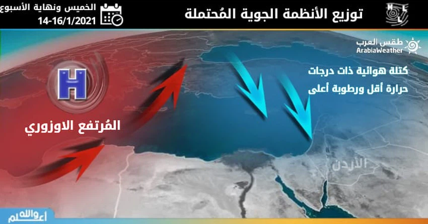
Radical changes are expected to air systems by the end of the week!

The Kingdom and the region are going through a long period of rain retreat, but according to the numerical treatment, a radical change is expected in the air systems by the end of this week, as the numerical output indicates the possibility of a sharp drop in temperatures starting from Thursday and during the weekend.
As the cold weather returns with activity on wind speed, rainfall indicators rise again, announcing the end of a long period of rain retreat, and the received indicators are monitored first, and reports and details will be issued more broadly when the time period approaches and the weather output is confirmed.
God knows.
Arabia Weather App
Download the app to receive weather notifications and more..


