Jordan | With scientific explanation...Arab Weather explains the reasons for the absence of weather conditions in the Kingdom
Arab Weather - The middle of December passed without any significant rainfall in the Kingdom, and the air depressions and cold and humid air masses are still far from the Kingdom, which puts the rainy season in real danger if the current season continues to perform as it is now.
December rains are considered important for the region and constitute a good percentage of the rainy season’s performance, as December is considered the beginning of winter meteorologically, and the winter square begins in the last third of it and lasts for 40 days, which is relied upon in terms of providing the rainy season with the largest possible amounts of rain during the season.
Arab Weather explains the scientific reasons behind the absence of weather conditions in the Kingdom
The experts at "Arab Weather" said that the absence of weather conditions in the Kingdom and the weak rainfall so far can be summarized by the following reasons:
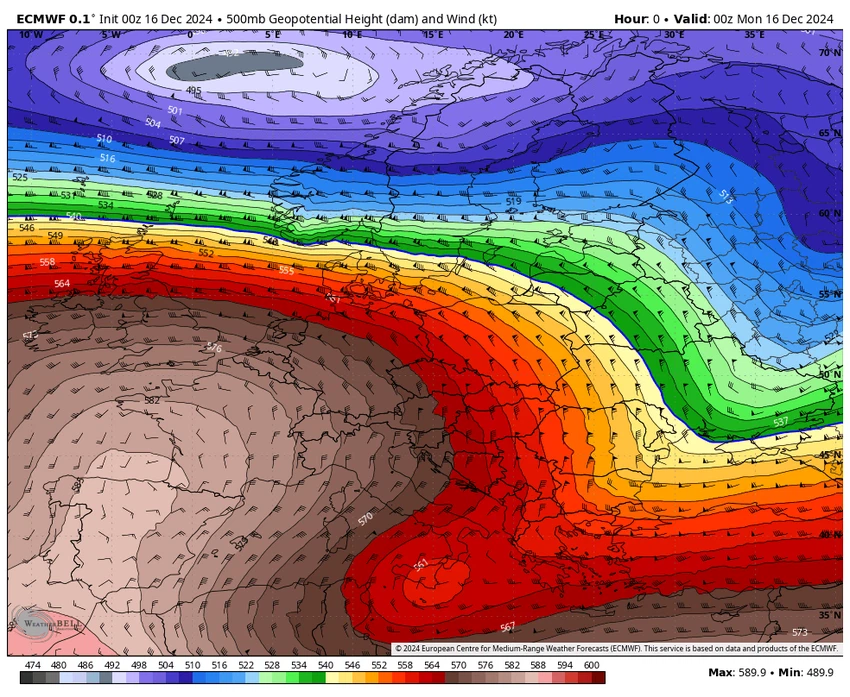
Cold and humid air masses and weather conditions focus on central and southern Europe and the central Mediterranean.
As of the beginning of December, an atmospheric system dominated the northern hemisphere, represented by the concentration of the polar jet stream towards central and western Europe and the central Mediterranean. The polar jet stream is considered responsible, after God’s will, for directing cold and humid air masses from the North Pole towards the middle and lower latitudes, and thus the activity of cold and humid air masses is concentrated in the areas mentioned above.
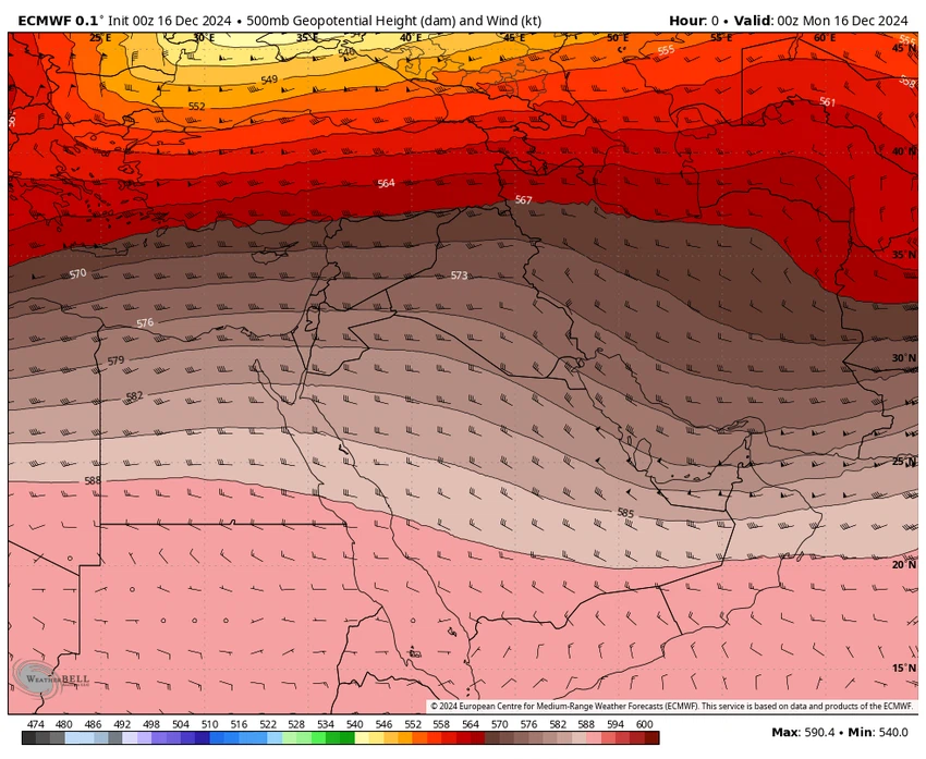
A high pressure area continues to extend from the south towards the region.

As a natural reaction of the atmosphere, the cold air masses focused on the center and west of the European continent, forcing an area of high air pressure located to the south of the Kingdom to continuously expand towards the region, bringing with it a warmer than usual air mass and stability in the atmosphere in general.
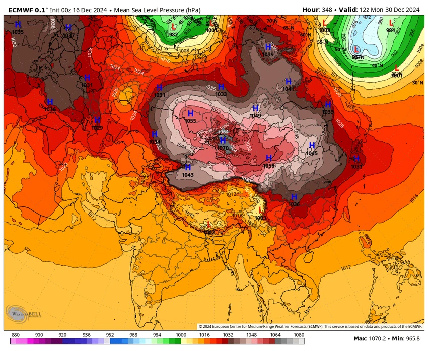
The Siberian high extends from the east towards the region at intervals.

The experts at "Arab Weather" said that the expansion of the Siberian high pressure system towards the region plays a major role in the absence of rainy weather conditions in the region, as the Siberian high pressure system, when it expands and extends towards the region, acts as a barrier to the cold air masses coming from northern and central Europe and prevents the formation of air depressions in the Cyprus Basin, thus bringing with it stable, dry and very cold weather.
We ask God to grant us abundant rain and not make us among the despairing.
Arabia Weather App
Download the app to receive weather notifications and more..


