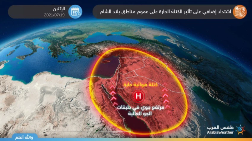
Levant | Alert from the peak of the impact of the heat mass on the region on Monday, and the temperature touches 40 degrees Celsius in many areas
Arab Weather - The internally developed weather maps by Arab Weather indicate an expected intensification of the impact of the hot mass on all regions of the Levant on Monday, as the rush and control of the hot air mass coming from the desert of the Arabian Peninsula over the Levant over the Levant and thus entering the region at the peak of the hot mass effect .
Additional intensification of the effect of the hot mass Monday
In the details, it is expected that there will be another rise in temperatures on Monday, so that they will become much higher than their rates for this time of the year, and the weather will be generally hot and dry in most areas, and temperatures will be between 37-40 degrees Celsius in many villages and cities of the country. Levant, including the capital Amman, Al-Quds Al-Sharif and Damascus, while it is more moderate in the coastal areas, especially Beirut, and temperatures approach 45 degrees Celsius in some areas of the Jordan Valley and desert areas, and the winds are northwest to moderate in speed, active sometimes and may be Dust and dirt repellent.

At night, the temperatures continue to be high compared to those that prevailed during the past days, and the weather is generally warm in most areas, while it tends to heat in low areas, and the winds are generally moderate, coinciding with the high levels of surface humidity in the western mountain slopes of the country. Sham, which may lead to the formation of light fog.
The direct reason for the impact of the rest of the Levant on the hot air mass is due to the rush of a relatively cold air mass in the middle of the European continent and accompanying an air depression in the upper layers of the atmosphere. The dynamic methods, which are represented in the control of high air pressures over an area corresponding to low air pressures in another area, as with the rush of a relatively cold air mass in the middle of the old continent, which works to intensify the subtropical high air and deepen the pressure values in the thermal depressions on the Arabian Peninsula and sometimes approach them towards the Levant.
Given the expected intensification of the hot mass on Monday, there are a set of important recommendations that must be taken seriously in dealing with such an atmosphere, summarized in the following points:
- Avoid exposure to the sun all hours of the day.
- Drink plenty of cold fluids and refreshments throughout the day and even at night, even if you are not thirsty.
- It is advised not to exert physical exertion outside most of the time because very high temperatures will increase the so-called heat stress.
- Attention not to leave sterilizers and any flammable materials inside the vehicles.
- Attention not to leave children inside vehicles, even for a short period of time.
Suggested topics:
- video | A strong sandstorm hits Riyadh, and the horizontal visibility is close to zero!
Arabia Weather App
Download the app to receive weather notifications and more..


