North Pole | Heralding the approach of autumn.. Monitoring the development of the polar vortex and the activity of the polar jet stream
Arab Weather - Weather forecasters at the "Arab Weather" Center are following the latest developments in the polar vortex in the North Pole, as the latest weather map outputs indicate noticeable activity in the polar jet stream and the storminess of polar winds in the northern hemisphere, specifically the North Pole, which heralds the approaching start of autumn in northern Europe and the European continent.
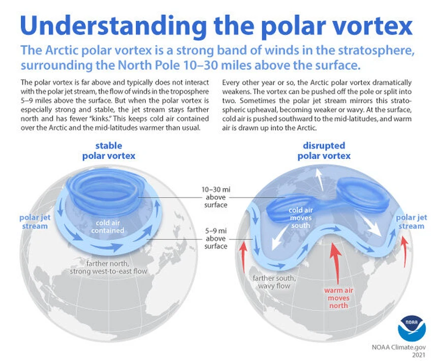
What is the polar vortex and the polar jet stream?
The polar vortex is an area of low atmospheric pressure surrounded by a belt of strong winds that are active very quickly in the upper atmosphere, the stratosphere. The polar vortex gradually becomes active as we enter autumn and becomes stronger in winter, due to the sun starting to move away from the Tropic of Cancer and thus the weakening of solar radiation falling on the North Pole, which leads to increased cooling of the layers of the atmosphere in the North Pole, which increases the activity of polar depressions in the Arctic Circle.

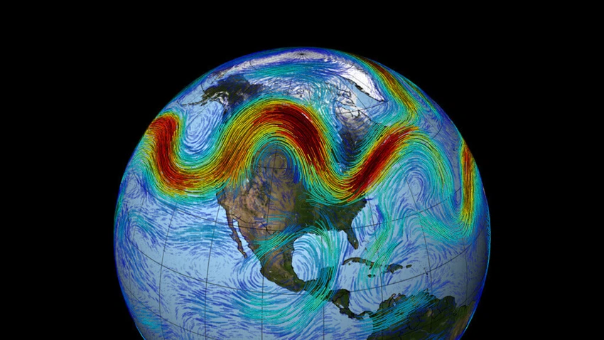
The polar jet stream is a belt of fast-flowing air currents, typically moving from west to east, at high altitudes in the atmosphere. It is formed by temperature differences between air masses, and plays an important role in influencing weather patterns. It travels in a wave pattern and moves at very high speeds, driven by temperature differences between cold polar air in the north and warmer tropical air in the south. The jet stream also affects weather patterns and the movement of weather systems, and its location and strength can change, affecting short-term weather conditions and even long-term climate patterns.

How will the maturing polar vortex affect the Northern Hemisphere over the coming weeks?
The experts at "Arab Weather" said that the maturation of the polar vortex and the increase in the strength of the polar depressions in the Arctic Circle, and the beginning of the undulation of the polar jet stream, will help the cold air to begin to undulate and descend to levels below the Arctic Circle, and thus the beginning of the cold air rushing towards the north and center of the European continent, and later its south.
Arab Weather forecasters said that this matter has already begun to appear in the maturity of autumn conditions in several parts of the European continent, as several parts of central and southern Europe are exposed to thunderstorms as a result of the temperature differences between the cold air coming from northern Europe and the warm and humid air present in northern Europe.
It is expected that, gradually, during the coming months and the fall, the polar vortex activity will increase, as is the case in every season, and thus the early basins will reach the middle and low latitudes, which will activate cases of instability and air depressions, including the Arab countries, God willing.
Arabia Weather App
Download the app to receive weather notifications and more..


