Polar winds and snow showers are expected in many mountainous areas in the Levant, coinciding with the first days of spring.
Arab Weather - The latest remote sensing images show a low-pressure system moving eastward, followed by a polar air mass with polar characteristics, which coincides with the advance of more rain clouds to various regions of the Levant. Rain, God willing, will fall intermittently, sometimes torrential and accompanied by heavy hail showers. Heavy snow is expected to fall over the high mountainous areas of Syria and Lebanon, coinciding with the flow of polar winds.
Snow is expected in the mountainous areas of Syria and Lebanon tonight, at dawn, and on Friday morning.
God willing, and due to the severe cooling of the air mass across the various layers of the atmosphere, intermittent snow is expected to fall on the highlands of Syria and Lebanon tonight and Friday morning, amid bitterly cold winter weather. Snow showers are also likely to fall at lower elevations in Syria and parts of Lebanon.
Rain is also expected to fall on the Syrian and Lebanese coasts, as well as parts of Palestine and Jordan at intervals, with low clouds touching the ground, leading to the formation of dense fog at intervals.
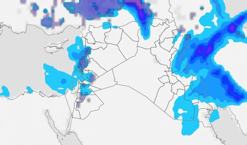
In Jordan, there is a chance of snow showers falling on the high mountain peaks in the north, center, and south of the Kingdom, in addition to the peaks of the northeastern Badia. Snow may accumulate at times, especially on the peaks of Jerash and Ajloun. It is also likely to accumulate occasionally on the peaks of Al-Qadisiyah and Al-Rashadiyah in Tafilah Governorate, the peaks of Shobak and Taybeh in the south, and the peaks surrounding Petra and Wadi Musa.
And God knows best.


Arabia Weather App
Download the app to receive weather notifications and more..