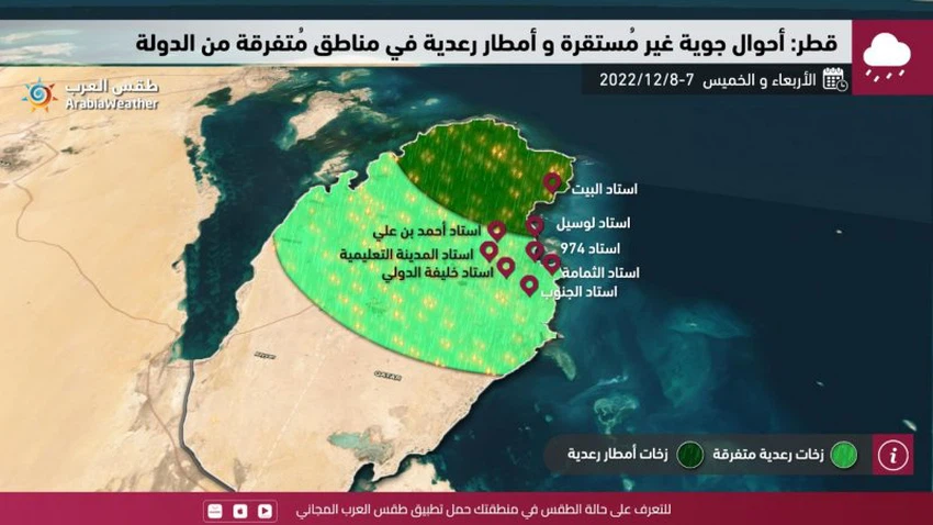
Qatar: Unstable weather conditions and thunderstorms in some areas at the end of the week
Weather of Arabia - The latest weather maps indicate expectations that different parts of Qatar will be affected this weekend by an air depression in the upper atmosphere, accompanied by a cold air mass that converges with the extension of the Red Sea depression from the south. This convergence coincides with an influx of moisture in the different layers of the atmosphere, and these conditions work God willing, rainy clouds will multiply over the Gulf basin, and some areas will reach, God willing.
And in the details, temperatures are expected to drop on Wednesday, and the weather will be hot in most regions, and quantities of clouds will gradually multiply after the noon hours at different altitudes, and sporadic showers of rain will fall in parts of the north and east of the country, and they will be accompanied by the occurrence of Thunder sometimes and activity in active winds during the passage of thunderclouds.

It is expected that chances of rain will remain in parts of northern and central Qatar on Thursday, and the wind will be northwesterly moderate.
God knows.
Arabia Weather App
Download the app to receive weather notifications and more..


