Rain and hail to affect large parts of Saudi Arabia over the next 36 hours
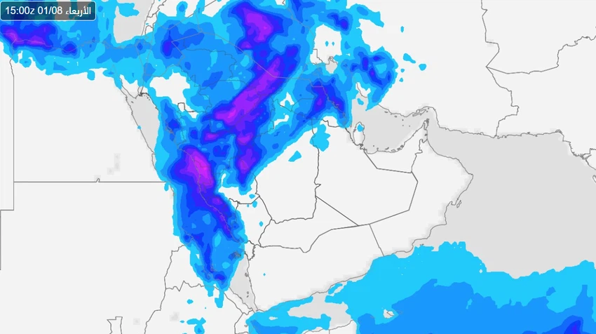
Arab Weather - Sinan Khalaf - The latest weather maps and analyses of the Arab Weather forecast team indicate that the Kingdom will gradually begin to be affected, starting from today, Sunday, by a state of atmospheric instability, generally characterized by severity and comprehensiveness , as it is expected that a cold upper basin coming from the north will rush towards the Kingdom, coinciding with the activity of the Red Sea depression, which works to form cumulonimbus clouds and rainfall and hail over large parts of the Kingdom.
Rainy conditions start from Tabuk on Sunday afternoon
Arab Weather experts believe that the actual start of the rainy situation will start from the Tabuk region during the afternoon hours of this Sunday, as cumulonimbus clouds appear and the opportunity is prepared for showers of rain to fall on the western strip extending from Umluj to Jabal Al-Lawz, and its scope of influence will expand rapidly to include large parts of the Al-Jawf region during the afternoon hours, as the mentioned areas are expected to witness rainfall of varying intensity, accompanied by lightning, thunder and active surface winds.

The cold upper basin deepens, and rain intensifies and becomes more comprehensive Sunday night
During the night hours, the cold upper basin is expected to deepen in the atmosphere of the western parts of the Kingdom, clouds will multiply and rain will fall in the form of showers of varying intensity in different parts of the Medina region, and will later extend during the night to include different parts of Hail and the northern border, while the weather will return to stability in Tabuk and Al-Jawf.
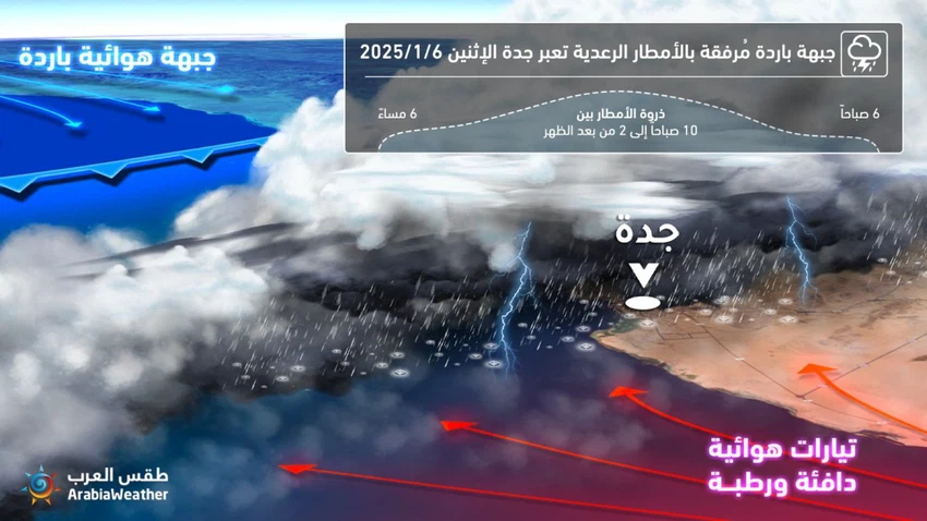
A cold front crosses the skies of Jeddah, and thunderstorms are expected on Monday
Arab Weather experts expect that the cold front will begin to cross the skies of Jeddah starting from the morning hours of Monday, so that the clouds will multiply and the opportunity will gradually be prepared for showers of rain, which will sometimes become heavy and accompanied by showers of hail. It is also not unlikely that the region will witness descending winds, and the rain will include at the same time parts of Hail and Qassim, reaching Hafar Al-Batin and Rafha with varying intensity.

Cold front crosses Makkah Al-Mukarramah skies at dawn on Monday, accompanied by thunderstorms
On Monday night, the cold front will move to begin crossing the skies of Makkah Al-Mukarramah and the holy sites, so that the weather will turn cloudy and rainy at times, accompanied by lightning, thunder and hail showers. It is also not unlikely that it will also be affected by descending winds at times, so that the weather will gradually return to stability starting from Tuesday dawn.
Will the rainy conditions include Riyadh and the Eastern Region?
Arab Weather experts believe that the chances of rain extending towards Riyadh will be likely starting Monday night, starting in the north of the Riyadh region, including Afif, Ad-Dawadmi and Artawiyah in the form of thunderstorms, extending later on Tuesday to include the capital in a scattered manner, while the eastern parts of the Kingdom are expected to witness scattered showers of rain on Tuesday night and during the hours of the day on Wednesday, and God knows best.
Arabia Weather App
Download the app to receive weather notifications and more..


