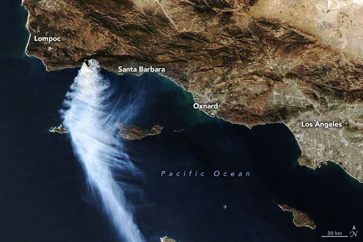
Satellite images of the massive smoke plume of the Southern California fire

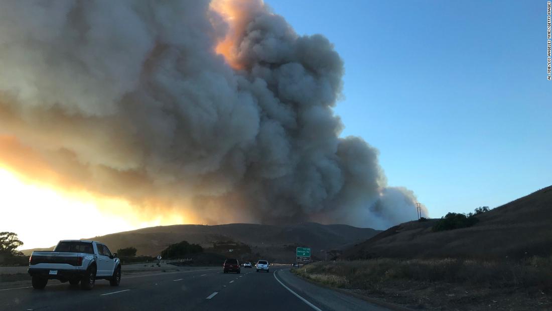
Weather of Arabia - Massive fires ignited in Northern California for most of the summer of 2021, and by mid-October, these fires were extinguished after destroying most of the forests, but new warnings were issued after violent fires began to cause problems in the shrublands and grasslands of Southern California.

On October 13, 2021, the Moderate Resolution Imaging Spectroradiometer (MODIS) on NASA's Aqua satellite captured this image of the Alisal fire northwest of Santa Barbara. Strong north winds pushed massive plumes of smoke over the Pacific Ocean.
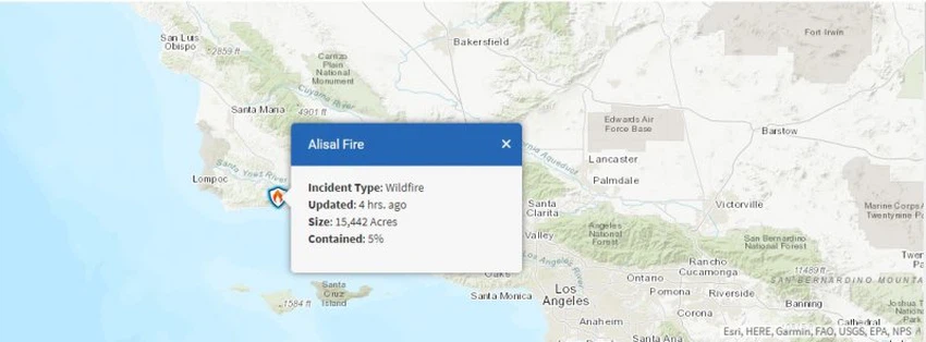
After a fire broke out on October 11 near the Alisal Reservoir in Solvang, a city in Santa Barbara County, California, the fire spread quickly and burned 15,442 acres (62.5 km2) as of the morning of October 14. In that time, the fire was 5% contained, with fire threatening at least 100 buildings, and authorities had issued evacuation orders and closed sections of Highway 101.


Arabia Weather App
Download the app to receive weather notifications and more..