Saudi Arabia Gradual increase in the case of air instability and alert of flash floods in Riyadh on Tuesday night / Wednesday
Weather of Arabia - A case of weather instability began affecting hours in the morning of Tuesday morning in northern Saudi Arabia, where thunderstorms of rain fell in both Al-Jouf and Tabuk regions, and these rain clouds would move towards the northern borders and Hail during the coming hours of Tuesday evening.
An increase in the state of air instability in the center, east and south of the Kingdom on Tuesday / Wednesday night
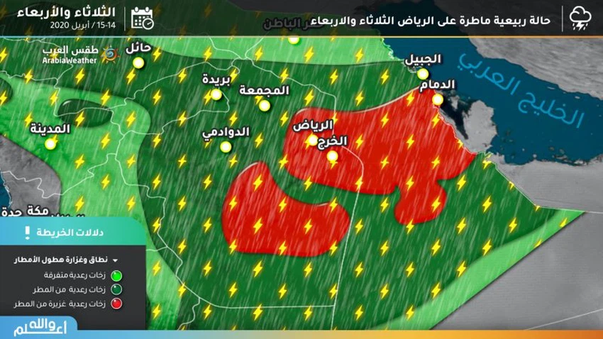
Cumulative thunderstorms begin to multiply over the whole central and southern regions of the Kingdom from Tuesday afternoon, which will rise to the west and south of the Riyadh region and southwestern highlands with afternoon and evening hours, and their effects will reach the capital Riyadh during the night hours, as heavy rain falls in the capital. It is associated with falling grains of cold and activity in the exciting wind speeds of dust and dust.

The expected instability is expected to reach its climax in the capital Riyadh next night and Wednesday between medium and strong. Therefore, the Arab weather warns of the high levels of water in the streets and roads during the thunderstorm period.
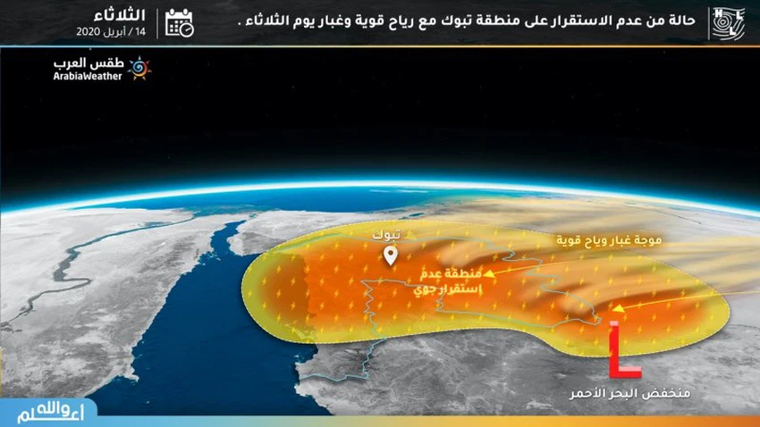
Active winds and dust on the north and northwest of the Kingdom
A shallow air depression is concentrated over the Al Madinah Al Munawwarah region on Tuesday, pushing northeasterly winds to the east over the Tabuk, Al Jawf, Hail and Al Madinah Al Munawwarah regions, where opportunities for the formation of dust waves increase in those areas.

Arabia Weather App
Download the app to receive weather notifications and more..


