Saudi Arabia Monitor the emergence of a situation of air instability at the end of the week
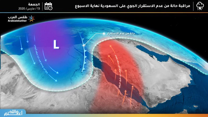
Weather of Arabia - Outputs of numerical models that are turned on by Arab weather indicate expectations of the emergence of a situation of air instability in the Kingdom during the weekend, bringing with it unstable weather, rain and dust to the northern region and then later the central and eastern region, but given the length of time, details remain The situation and its strength are unclear and will be addressed in future releases.
The reason for the state of air instability expected to emerge at the end of the week is due to a cold air mass rush from Europe towards Egypt and Sudan, this will work on the opposite push for a hot and humid air mass originating in eastern European continent. From the instability of the air to all of Egypt, the Levant and parts of Saudi Arabia this weekend.

With the Sudan depression extending northward towards the Levant through Egypt, Saudi Arabia and the whole north of the Red Sea, the eastern winds to the southeasterly provocative of dust and dust will be active from Thursday in the northern and central regions of the Kingdom.
Temperatures will rise significantly on Wednesday, as it may touch the 40 ° C barrier in the Tihama area and the coasts of Madinah and Tabuk to resume their decrease at the end of the week with the entry of a cold air mass accompanying the unstable air system.
The weather forecast staff in the Arab Weather will issue daily bulletins and updates of the expected situation, especially with the approaching time period and clarify the details more.
Arabia Weather App
Download the app to receive weather notifications and more..


