Saudi Arabia | The most prominent features of the rainy situation affecting the Kingdom at the end of the week
Arab weather - Sinan Khalaf - a new rainy condition awaited at the end of the week, but it is not like its predecessors from the many weather conditions that have affected the Kingdom since the beginning of the season. These features:
The prevailing air system
Effective response Red Sea depression
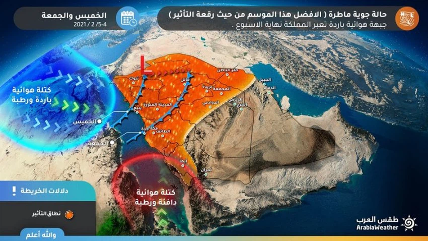
The region is approaching an air depression in the high air layers across Egypt and the eastern Mediterranean, in conjunction with the eruption of moist and warm subtropical currents from the southwest, and the displacement of the subtropical high altitude from the atmospheres of the north and west of the Arabian Peninsula, which means an effective and strong response to the Red Sea thermal depression at dawn On Thursday morning, before it turns into a frontal depression during the day, it forms a cold air front that creates strong thunderstorms and heavy rain falls in large areas.

Wide impact area
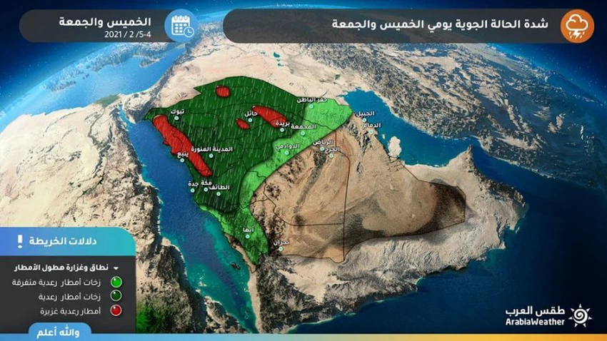
Heavy rain and hail showers in large geographical areas
The expected situation at the end of the week is characterized by the intensity and the abundance of rain and the widening of the impact in terms of geographical area, as it is expected that, with its heavy and moderate rains, Tabuk, Al-Jawf, Hail and Al-Qassim region, in addition to the northern borders and Hafar Al-Batin, and thunder clouds extend to include the whole region of Medina and parts of Makkah It includes the city of Jeddah, in addition to Taif, sometimes accompanied by cold and surface wind activity, and the courtyard is also affected by the rainy condition, but in a weaker way.

Strong cumulus clouds
It is characterized by the intensity of thunderstorms and the frequent lightning strikes
The rush of the warm and humid air mass towards the western sector of the Kingdom will create a state of atmospheric instability, during which cumulative thunderstorms are formed, characterized by the intensity of the accompanying thunderstorms and the abundance of lightning strikes.

Downwinds
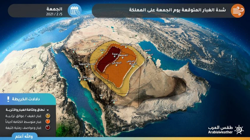
Dust waves are expected
Perhaps the most prominent characteristic of this rainy situation is the strength of the downward winds associated with thunder clouds or accompanying the cold front, and these winds will stir up meadows of dust and dust, sometimes in the form of wall sandstorms, which greatly limit the horizontal vision, and may harm patients with the respiratory system and eyes. .
Arabia Weather App
Download the app to receive weather notifications and more..


