Saudi Arabia | The spread of the influence of the state of air instability Wednesday

Arab Weather - Temperatures rise on Tuesday in the west and north of the Kingdom due to warm southerly winds coming from the south of the Red Sea, in conjunction with the continuing relatively cold weather in the east and center of the country, where temperatures are slightly lower than their average in those regions.
The opportunity is also ripe for thunderstorms of rain in the Al-Qassim region and the southwestern region, with light intensities as a whole.
The spread of air instability in the west of the Kingdom on Wednesday
A cold air mass is approaching the north of the Kingdom on Wednesday, as this air mass is expanding the area of air instability in the west of the Kingdom, to include all of the regions of Jazan, Asir, Al-Baha, Makkah and the Jeddah region, including the city of Jeddah, and then extends later to the west and north of the Riyadh region And the Qassim region and down to Hafar Al-Batin.
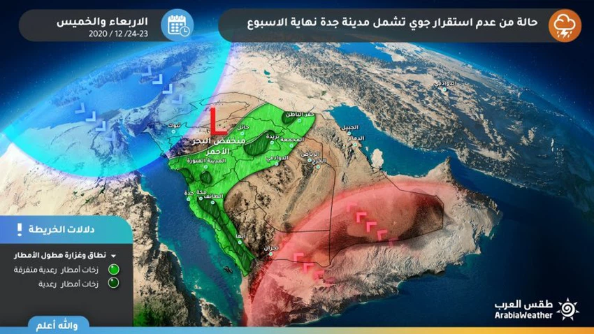
The rains are generally light with heavy foci in the narrow ranges of the southwestern highlands and the Qassim and Hafar Al-Batin regions.


Arabia Weather App
Download the app to receive weather notifications and more..