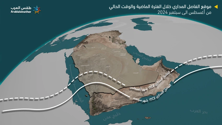
Saudi Arabia Weather | The tropical dividing line begins to withdraw towards the south.. How does it affect the rain reality?
Arab Weather - The latest computer modeling outputs sense changes in the prevailing weather patterns in the Arabian Peninsula during the coming week, coinciding with our approaching the fall season, most notably the beginning of the withdrawal of the tropical divider line (ITCZ) towards the south, which will be reflected in the rainy reality for the remainder of this month as follows:
The moisture tide has been cut off from the highlands of Taif, Mecca and Medina
The withdrawal of the ITCZ towards the south is considered a negative factor that leads to a significant reduction in the flow of tropical moisture, which is the main element for the formation of cumulonimbus clouds that carry rain over the highlands of Makkah Al-Mukarramah, Taif, and the Madinah region. With this withdrawal, the chances of moisture flow weaken, and may disappear completely, to be replaced by dry winds that will once again plunge these regions into a state of drought, with the chances of rainfall fading.

2- Decrease in rainfall in the highlands of Jazan, Asir and Al-Baha.
Experts at the Arab Weather Regional Center believe that the infiltration of tropical moisture towards the highlands of the southwest of the Kingdom, specifically the highlands of Jazan, Asir and Al-Baha, will continue during the coming days, but in smaller quantities than in previous times. Therefore, the chances of the formation of cumulonimbus clouds on the highlands of these regions will continue, but with less intensity and comprehensiveness, and God knows best.
Arabia Weather App
Download the app to receive weather notifications and more..


