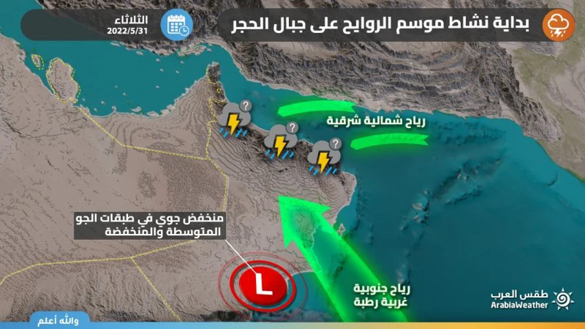
Sultanate of Oman: The start of the rainy season on the Hajar Mountains in the middle and end of this week
Arab Weather - Weather maps, through the Badr system developed by Arab Weather , indicate expectations of renewed activity of cumulus formations on the Hajar Mountains and Dhofar, as of Tuesday, 05/31-2022, stimulated by an air depression in the low and middle layers of the atmosphere coinciding with the blowing of a moist sea breeze.
The start of the rainy season
Rain of varying intensity, sometimes heavy in some areas
In the details, it is expected that the chances of cumulus formations on the Al Hajar Mountains will start on Tuesday, and that the cumulus rainy clouds will intensify and expand on Wednesday to include large parts of the Al Hajar Mountains, especially Al Hajar Al Awsat. These clouds are accompanied by showers of varying intensity in some areas accompanied by lightning. And thunder sometimes, God willing. Simultaneously, it is expected that rains of varying intensity will fall on the mountains of Dhofar Governorate, starting from Wednesday.

It is noteworthy that the Sultanate is at the gates of the season of Al-Rawaih, which are cumulus summer clouds that form on the Hajar Mountains, and their precipitation begins at the beginning of the months of July and reaches its peak during the month of August. the cold.
Arabia Weather App
Download the app to receive weather notifications and more..


