Sultanate of Oman | There will be an improvement in the weather at the end of the week (a clear decrease and the appearance of clouds), and an eastern wave will be observed at this time. Details
Arabia Weather - Meteorological specialists at the Regional Arab Weather Center said that the latest outputs received from computer simulations, especially those showing the temperature trajectory, show that the Sultanate is on the verge of a relief in the weather and a clear decline in the severity of the heat during the weekend due to the arrival of humid air currents with lower temperatures. From the waters of the Arabian Sea with the appearance of quantities of clouds, and specialists are monitoring the crossing of an eastern wave next week that will return and activate thunderstorms on the Hajar mountain ranges and neighboring areas.
A drop in temperatures at the end of the week and the appearance of amounts of clouds in the air
In the same context, it is expected, God willing, that there will be a clear drop in temperatures in several states of the Sultanate during the weekend (Friday and Saturday), but the weather will remain hot in general, with temperatures in the forties in general, and quantities of clouds will appear at different altitudes. Thus The weather will be partly cloudy to cloudy in some periods and humid in many areas, and some of these clouds can cause local rain in limited places. It is also not excluded that some cumulus formations will occur in parts of the Hajar Mountains, accompanied by rainfall.
Temperatures and weather conditions in Muscat in the coming days
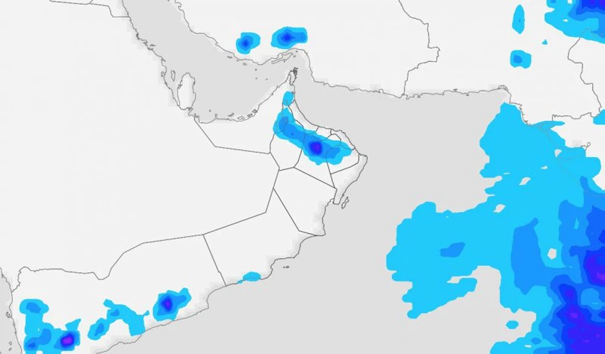
Under watch: An eastern wave will cross the Sultanate’s airspace next week, with thunderstorms on the mountains reviving
For their part, weather specialists at the Arabia Weather Center said that the latest computer data received by the Air Control Center indicate that there are indications that the Sultanate of Oman will be affected during the next week, especially its end, by an eastern wave that will cause the return of seasonal thunderstorm activity on the northern mountain ranges (Al-Hijr) and the surrounding areas, and the accompanying weather conditions. There may be heavy rain, hail, and falling winds that cause dust waves to form.

An easterly wave is a type of atmospheric groove, a long area of relatively low air pressure, oriented north to south, that moves east to west across the tropics, causing areas of cloudiness and thunderstorms. In other words, they are disturbances in the low and middle layers of the atmosphere through which the eastern trade winds pass north of the equator.
Tropical waves form in easterly flow along the equatorial side of the subtropical ridge or high air pressure belt that lies north and south of the Intertropical Convergence Zone (ITCZ). Tropical waves are usually transported westward by prevailing easterly winds along the equatorial and subtropical regions near the ITCZ. Leveling. It can lead to the formation of tropical cyclones in the North Atlantic and Northeast Pacific basins.
God knows.
Arabia Weather App
Download the app to receive weather notifications and more..


