Sultanate of Oman: Thunderstorms will renew in the Hajar Mountains and neighboring states in the coming days
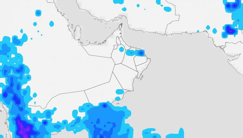
Weather of Arabia - Weather readings indicate that the opportunity is expected to remain ripe for cumulus clouds to multiply over the Hajar Mountains and its neighboring states during the coming days, as a result of the presence of an air depression in the upper layers of the atmosphere near the Sultanate's atmosphere, in conjunction with a moisture tide coming from the Arabian Sea.
And it is expected, God willing, that the activity of cumulus clouds will resume during the afternoon and evening of Wednesday over parts of the Hajar Mountains, including the heights of South Muscat, North Sharqiyah, Al Dakhiliyah and Al Dhahirah, and it will be accompanied by sporadic rains that may be accompanied by the occurrence of thunder at times and activity in the mountains. Downwind. It is possible that the chances of rain will also include the neighboring states, in addition to the possibility of some rain clouds extending to parts of the coasts of the Sea of Oman, including the capital.
The opportunity remains ripe for sporadic rains on parts of the coasts and mountains of Dhofar Governorate, in addition to the neighboring wilayats.

Chances of thunderstorms will continue on the Hajar Mountains and a number of neighboring states during the weekend, God willing. However, the numerical outputs indicate that the subtropical air high is expected to begin to intensify over the Sultanate's skies next week, which will lead to a decrease in the chances of rain, and that temperatures will rise in most regions.
God knows.
Arabia Weather App
Download the app to receive weather notifications and more..


