Summary of the Khamsini depression that affected Jordan and the second-degree air depression

Arab Weather - The Kingdom was affected by a quintuple air depression on Tuesday / Wednesday night and continued until Thursday evening hours before it turned into a winter air depression of the second (medium) degree - Details
The depression was concentrated on the night of Tuesday / Wednesday over the Egyptian territory, and it caused a significant rise in the night temperatures, and an atmosphere was warmer than usual for the night hours.
And with the hours of the day on Wednesday, the concentration of the Khamsini depression on the northeastern coast of the Egyptian lands and the pushing of a warm and dry air mass and caused a warmer atmosphere for this time of the year, and the highest temperatures have been recorded since the fall of 2020, and the temperatures exceeded the mid-thirties in the Al-Agwa, the Dead Sea and Aqaba
Remarkably dusty weather prevailed during the day in the southern and eastern regions of the Kingdom, and to a lesser extent in the northern and central regions
The Kingdom was affected by a winter air depression on Thursday evening 11-3-2021
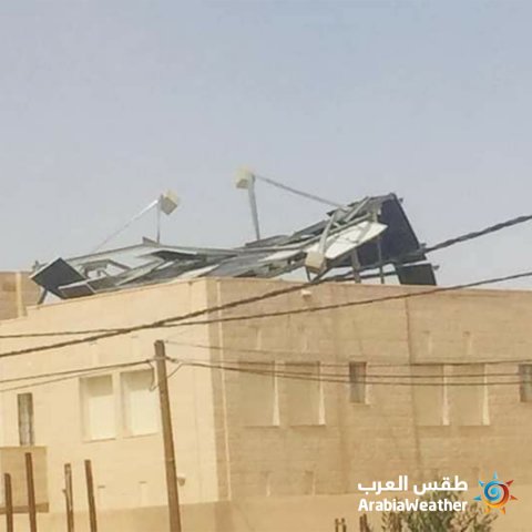
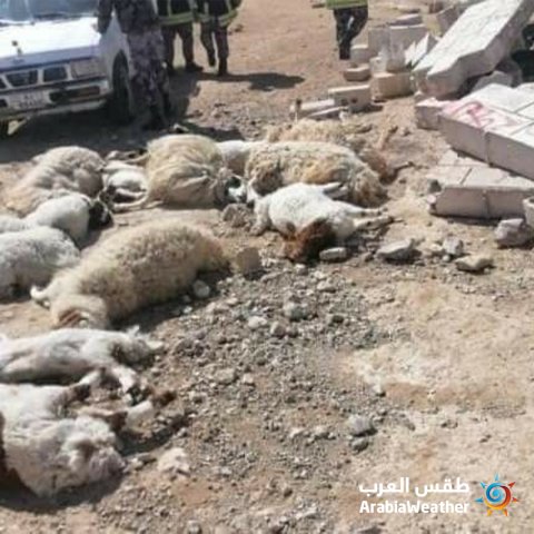
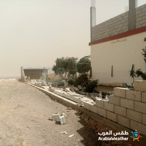
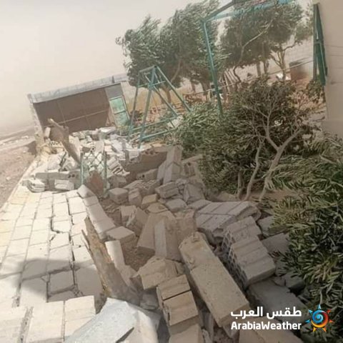
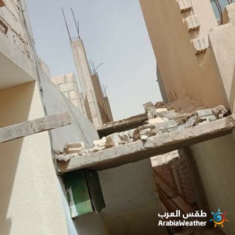
With the midnight hours of Thursday / Friday, a highly effective air front, accompanied by an air depression, began to cross the Kingdom's airspace, as the weather turned into storm and heavy rain in the north of the country, then this cold front moved towards the central region, including the capital Amman, then parts of the eastern and southern regions, and during the crossing of the front The winds gusted more than 100 km / hr in many areas.
During the morning hours of Friday, the cold front was over the Iraqi lands, and the torrential rains receded, and the weather turned cloudy and rainy at intervals, but strong winds continued to blow and severe sandstorms formed in the desert areas, and the horizontal visibility in the southern desert, the eastern region, and the desert road decreased.
But with the hours of Friday evening, the depression expanded to be replaced by an air high and the speed of these winds decreased and the clouds disappeared from the sky and became clear, but generally cold.
The quantities of rain that were recorded during the second (medium) winter depression, according to the Arab weather stations:

Public Security and Civil Defense cadres have dealt with removing sand dunes that were brought by the winds to the streets, as the thickness of the sand reached more than 10 cm in some areas.


Scenes of some damage caused by strong winds that exceeded the 100 km / h mark


Arabia Weather App
Download the app to receive weather notifications and more..