The Levant | Contrasted temperatures next week and a five-day depression on its way to the country
Arab Weather - The whole region of the Levant is witnessing major changes and significant differences in temperature since the beginning of May, while the latest weather forecasts indicate the continuation of this change and the variation in temperatures between today and the next during the next week.
Start a warm spring week
It is expected that temperatures will tend to rise slightly on Sunday, while remaining around slightly higher than their rates for such time of year, and the weather will be warm to relatively hot in all cities and governorates of the Levant, and quantities of clouds appear at high altitudes, especially in Palestine and Jordan. The winds will be northwesterly light to moderate in speed.
A pentagonal depression accompanied by a hot atmosphere on Monday
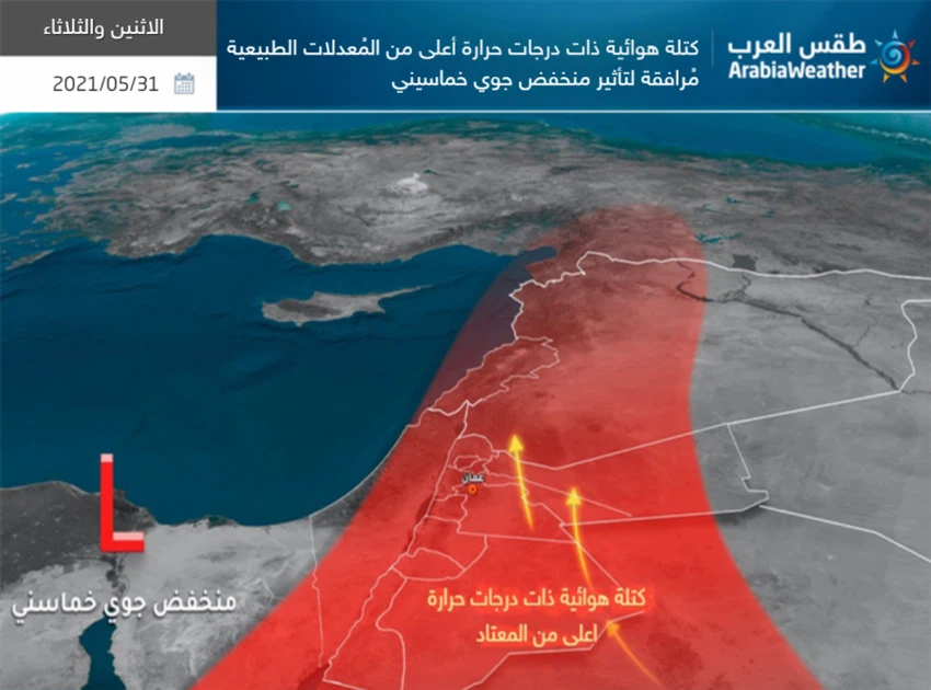
On Monday, the weather systems are represented by the approach of a five-point depression and an air mass with higher than normal temperatures accompanying it and coming from the African Sahara, where temperatures rise significantly, and the weather is relatively hot in the mountain heights and hot in the rest of the regions, as the weather is dry, it turns Gradually to dusty, especially with the afternoon hours, especially in the Syrian and Jordanian desert, and the winds will be northwesterly moderate in speed in Palestine and Jordan, while they are southwesterly moderate, active at times in Syria and Lebanon.

The temperatures are also higher at night compared to the previous nights, and pleasant weather prevails in the plains and mountains, and moderate in the rest of the regions with a significant decrease in surface humidity.
A slight drop in the heat on Tuesday as the weather remains hot
Temperatures will drop slightly on Tuesday, with the weather remaining relatively hot in the mountainous highlands, hot in the rest of the regions, and temperatures slightly higher than their general averages, and medium and high clouds form during the afternoon and afternoon hours in random areas of Syria and Lebanon, which may cause some sporadic rain showers Especially southern Syria.
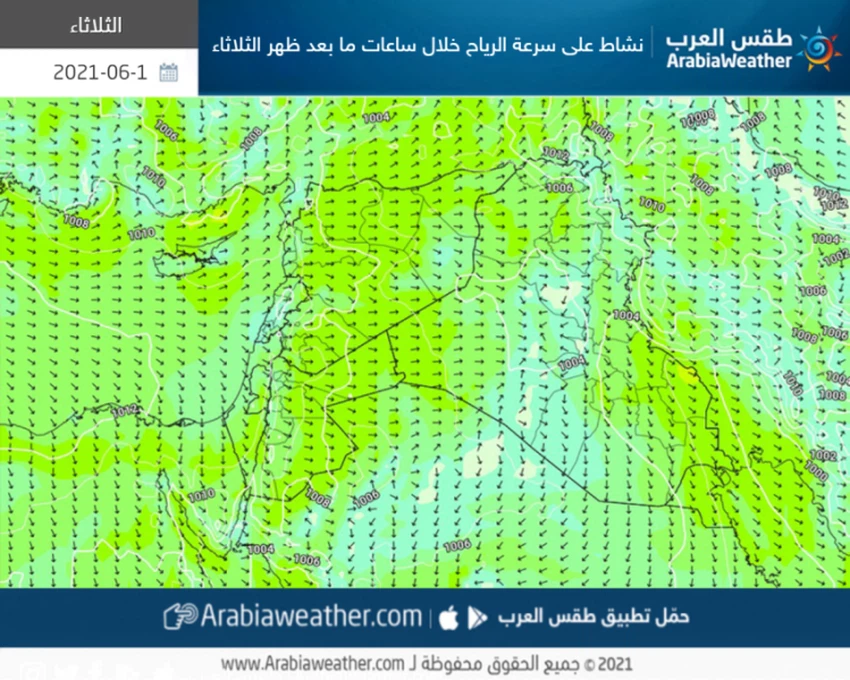
With the fifth air depression approaching the country more, to be concentrated on Tuesday over the Syrian lands, this depression is accompanied by a clear activity on the movement of winds that raise dust and dust in some areas, especially the desert areas located in southern and eastern Jordan and eastern Syria.

A gradual drop in temperature from Wednesday
The Khamasini depression moves towards Iraq, to push an air mass with temperatures around the average behind the Khamasini low on Wednesday, which works on a decrease in temperatures from Wednesday until the end of the week, with the appearance of some low clouds, after which local showers of rain fall on parts of the coast of Syria And Lebanon may extend to some interior regions, and the winds will be westerly moderate, active at times in Syria, Lebanon and Jordan, and they will cause dust in the Syrian and Jordanian badlands.
Also, there is a decrease in the night temperatures compared to the previous nights, and the weather turns to be pleasant, tends to be cold during the late night hours in the mountainous areas, with a rise in the humidity levels, and it is not unlikely that fog will form over the high mountain heights and the plains during the late night hours.
In contrast to expectations for a rise in temperatures on Monday and less on Tuesday, many websites and social media pages circulated stating that the Levant will be affected by a heat wave next week, but this is not correct, and Arab Weather returns here to review the definition of the heat wave scientifically, as a continuous and continuous rise Temperatures far from their usual rates of 4-6 degrees Celsius for three consecutive days over a wide geographical area.
Weather conditions and expected temperatures in the capitals of the Levant next week:
- The expected maximum temperature in Al-Quds Al-Sharif Sunday: 27 °
- The expected maximum temperature in Al-Quds Al-Sharif Monday: 34 °
- The expected maximum temperature in Al-Quds Al-Sharif Tuesday: 29 °
- The expected maximum temperature in Al-Quds Al-Sharif on Wednesday: 26 °
- The expected maximum temperature in Al-Quds Al-Sharif Thursday: 26 °
- The expected maximum temperature in Al-Quds Al-Sharif Friday: 26 °
- The expected maximum temperature in Amman Sunday: 27 ° -
- The expected maximum temperature in Amman Monday: 33 °
- The expected maximum temperature in Amman, Tuesday: 30 °
- The expected maximum temperature in Amman on Wednesday: 27 °
- The expected maximum temperature in Amman, Thursday: 27 °
- The expected maximum temperature in Amman, Friday: 27 °
- The expected maximum temperature in Beirut Sunday: 27 °
- The expected maximum temperature in Beirut Monday: 30 °
- The expected maximum temperature in Beirut on Tuesday: 27 °
- The expected maximum temperature in Beirut on Wednesday: 26 °
- The expected maximum temperature in Beirut Thursday: 26 °
- The expected maximum temperature in Beirut Friday: 26 °
- The expected maximum temperature in Damascus Sunday: 32 °
- The expected maximum temperature in Damascus Monday: 36 °
- The expected maximum temperature in Damascus Tuesday: 33 °
- The expected maximum temperature in Damascus on Wednesday: 32 °
- The expected maximum temperature in Damascus, Thursday: 33 °
- The expected maximum temperature in Damascus, Friday: 33 °
Arabia Weather App
Download the app to receive weather notifications and more..


