The weather of Arabia reveals the scientific reasons behind the large number of dust waves recently
Weather of Arabia - In less than a week, the Kingdom experienced a strong sandstorm and a strong dust wave, as the sandstorm hit the Kingdom on Saturday 24/4, a strong sandstorm that was generated over the Eastern Badia and moved to the main cities from the north, center and south and worked on a near-absence of visibility, reaching nearly Only 50 meters at Amman Airport, as for the second dusty wave that hit the Kingdom at dawn on April 29 and was generated in the southern Badia and also moved towards the rest of the regions and worked on a sharp decrease in the horizontal visibility to about 500 meters at Amman Airport, but what is the secret behind these dusty waves and why? Numerical maps encountered a lack of clarity in their prediction.
What is the secret behind these dust waves?
- Unstable weather conditions in the area
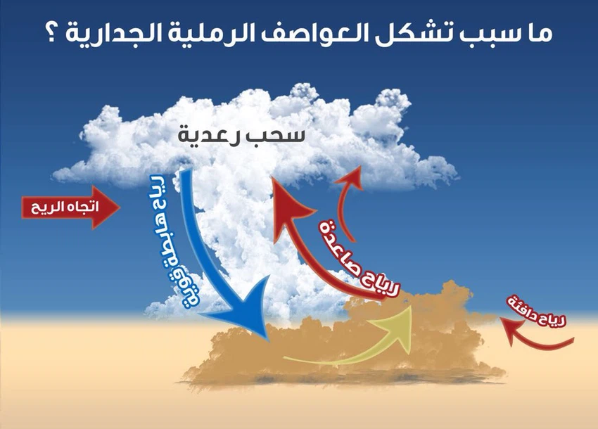
The Kingdom and the Levant, especially the eastern regions of it, up to Saudi Arabia and the Arabian Peninsula, live in unstable weather conditions, represented by the formation of thunder clouds, which concentrate their formation over desert areas. “) are strong surface winds emanating from an upper source and striking the earth’s surface radially, and in straight lines in all directions. They are often harmful winds.
The phenomenon of downward winds is accompanied by cumulus thunderclouds, especially dry ones. The phenomenon of downward winds abounds in the Arabian Peninsula and Transjordan, especially in the autumn season.
- How do downwinds arise?
Before entering into how the downward winds arise, it is necessary to refer to the physical properties of moist and dry air, and warm and cold air. Dry cold air is heavy in weight and dense, while warm, moist air is less in weight and density compared to dry cold air, as moist air is less in weight than dry air.

Here, it can be noted that downward winds arise due to the rush of dry winds to wet winds and vice versa, which causes strong cooling as a result of the process of evaporation of water vapor, especially when the lower layers of the atmosphere dry out and moisture is present in the middle and high layers of the atmosphere during the influence of cumulus clouds.
This means that air currents will be formed towards the earth due to the difference in the volume and density of cold and hot air. The speed of downward winds in some thunderstorms may reach 240 km/hour.
For this reason, numerical models have had great difficulty in predicting the dust waves that occurred recently due to this sudden atmospheric phenomenon, and they were only detected when they were formed via satellite images.
- Are downwinds the only major contributor to the formation of the last dust waves?

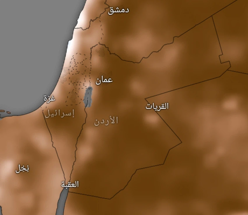
The answer is no. When we go back a little, we find that the southern and eastern regions of the Kingdom and the Badlands faced a severe shortage of rain this season, and after examining the soil moisture index, we find that the drought rate in the soil of the southeast and east of the Kingdom is very severe, which indicates the disintegration of the soil and therefore The chances of dense dust waves forming at any noticeable surface wind activity.
God knows.
Arabia Weather App
Download the app to receive weather notifications and more..


