Tuesday Continued instability and heavy rains in different areas of central and eastern Kingdom
The weather situation continues to affect the eastern regions and parts of the central, where it is expected to form a cold air front in the center and north-east of the Kingdom working to form cumulative rain clouds in the front, and with the movement of cold air mass in the upper atmosphere layers and deepen to the south, moving This front towards the south eastern regions and the capital Riyadh and the Empty Quarter.
#Urgent
Air Front Bring Thunderstorm to #Saudi and Gulf Countries from Tuesday to Friday, this video shows the time and spatial timing of the impact of this front on the region #Dammam_ now pic.twitter.com/HANRDcjbTMArabic Weather - Saudi Arabia (@ArabiaWeatherSA) November 18, 2019
Riyadh and the western regions and central regions:
Increasing the chances of rain showers in the capital Riyadh with the hours of dawn and early morning from Tuesday to evening hours, where the rains are generally demographic in nature with the presence of some medium foci, especially with the hours of dawn and afternoon hours and early evening.
While the opportunities are also preparing for the accumulation of cumulative clouds in the western parts of Riyadh districts of Dawadmi, Al-Badia, Al-Quway'iyah, Al-Muzahmiyah and surrounding areas during the early morning and early morning hours, renewed with noon and afternoon hours and continue until the evening hours.
Cumulonimbus is expected to form in different parts of Qassim and Hail, where light thunderstorms generally occur and are expected to be haphazard.
The reason for the instability is due to the presence of an air depression and a cold air mass over Iran, where it sends cool and humid winds towards the Kingdom, which meets warm and humid winds also coming from the Arabian Sea, where the point of convergence of these winds in the west and center of the Kingdom arise after the cumulative clouds.
Dammam and Eastern Region:
Numerical models indicate that the eastern region was affected by heavy rains accompanied by thunderstorms during Tuesday. Cumulus in the northern regions is expected to show up at dawn and early morning, with heavy thunderstorms from time to time accompanied by active winds and strong flashes.
With the afternoon and afternoon hours, clouds gradually move towards the southern regions of the eastern region of Jubail, Dammam and Khobar, with more cumulative clouds in these areas intensifying to cause heavy thunderstorms.
While in the evening the air activity begins to decline gradually with the opportunity to prepare for rainfall at special intervals areas of Hofuf, Dammam, Khobar and parts of the interior areas of Sarar and Arera.
He warns of rising water levels in roads and water bodies in the tunnels and valleys due to the heavy rainfall, which is expected to be over long periods.
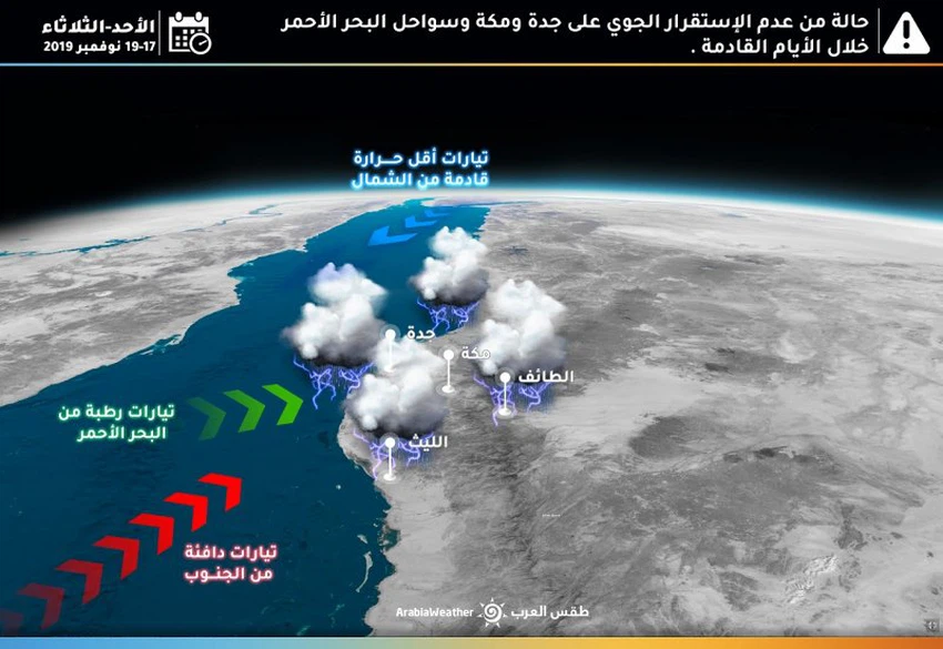
Makkah, Jeddah and Western Regions:
The presence of the Red Sea depression continues in conjunction with humid winds from the African continent and warm winds from the southern Red Sea. Such factors intensify cumulative clouds in different parts of the western coasts of the Kingdom.

It is expected that the coasts of Jeddah and the western interior between Al-Baha and Makkah will be affected by heavy thunderstorms that may be accompanied by some heavy showers, especially in the mountain areas between Al-Baha and Taif, where the chances of rain during the morning hours will be on the coastal areas. The opportunity is set with the afternoon and afternoon hours on the mountainous areas.
Arabia Weather App
Download the app to receive weather notifications and more..


