Weather of the week .. Higher than average temperatures on Egypt and thunderstorms of Gaza sometimes on the coast of the Red Sea
Arab weather ..Antonios Mekhiel. Weekly weather provides an overview of the most important weather systems and weather phenomena expected on Egypt, God willing, during the week.
During the first half of the week 10-12/11 / 2019:
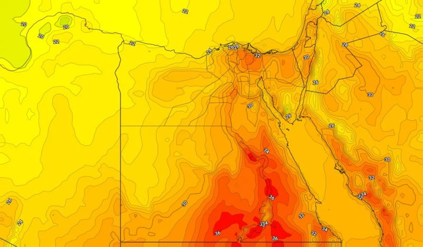
During this period, the weather system is characterized by a high elevation on the east of the African continent with an extension of the Red Sea depression, which keeps temperatures higher than average during the week in most regions.
Chance of rain and thunderstorms on the coast of the Red Sea with an opportunity to form torrents and high water levels, especially on Halayeb, Shalatin and Umm Ramad as a result of a state of air instability and the rush of some wet air masses to the coasts of the Red Sea, as the opportunity extends on the south and central Sinai and the cities of the Canal less strongly .
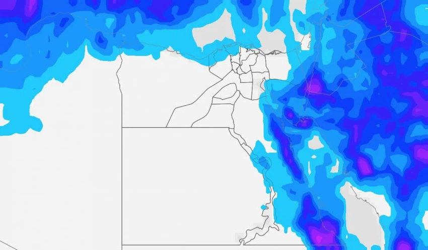
The chances of forming a water chloride continue with late evening hours and early morning on the interior of the northern coasts and the delta and may extend to Greater Cairo.
The winds are northern at moderate speeds on all areas, and there is an opportunity to form dust due to the downwinds associated with thunderstorms.
During the second half of the week 13-15/11 / 2019:
Most of the region remains under the influence of the upper and lower Red Sea so temperatures remain above their average levels but fall slightly over the weekend, helping to cool down the northwest coast.
Mild to moderate intensity showers are expected on parts of the northern coast as a result of a retreat in the upper elevation, with continued chances on the Red Sea, South and Central Sinai and Canal cities. Central Upper and Upper Upper Egypt.
The chances of formation of water chalk continued with the late evening hours and early morning on the interior of the northern coasts and the delta and may extend to Greater Cairo.
In the beginning of the period, the winds will be south to light to moderate speed.


Arabia Weather App
Download the app to receive weather notifications and more..